Back
Clear Spring
Area & Railroad Maps
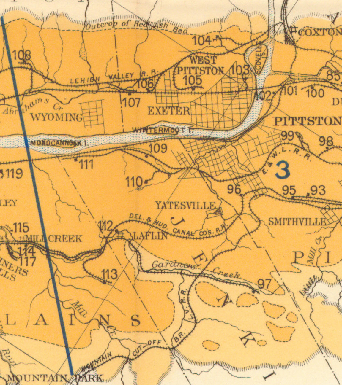
1887 2nd Pa Geo Survey sheet IX
1890 Northern Field (103) PSU
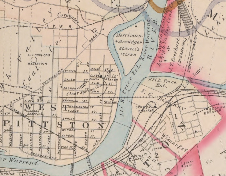
1894 Baist Atlas Wyoming and Lackawanna Valley Plate 5
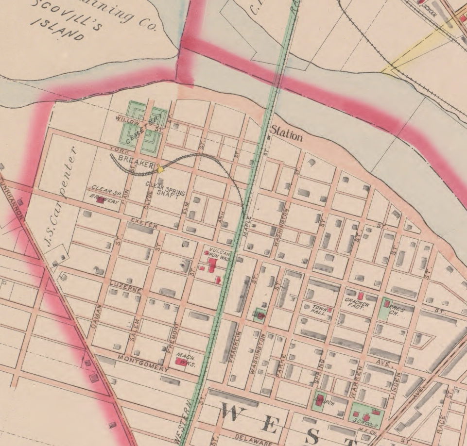
1894 Baist Atlas Wyoming and Lackawanna Valley Plate 6
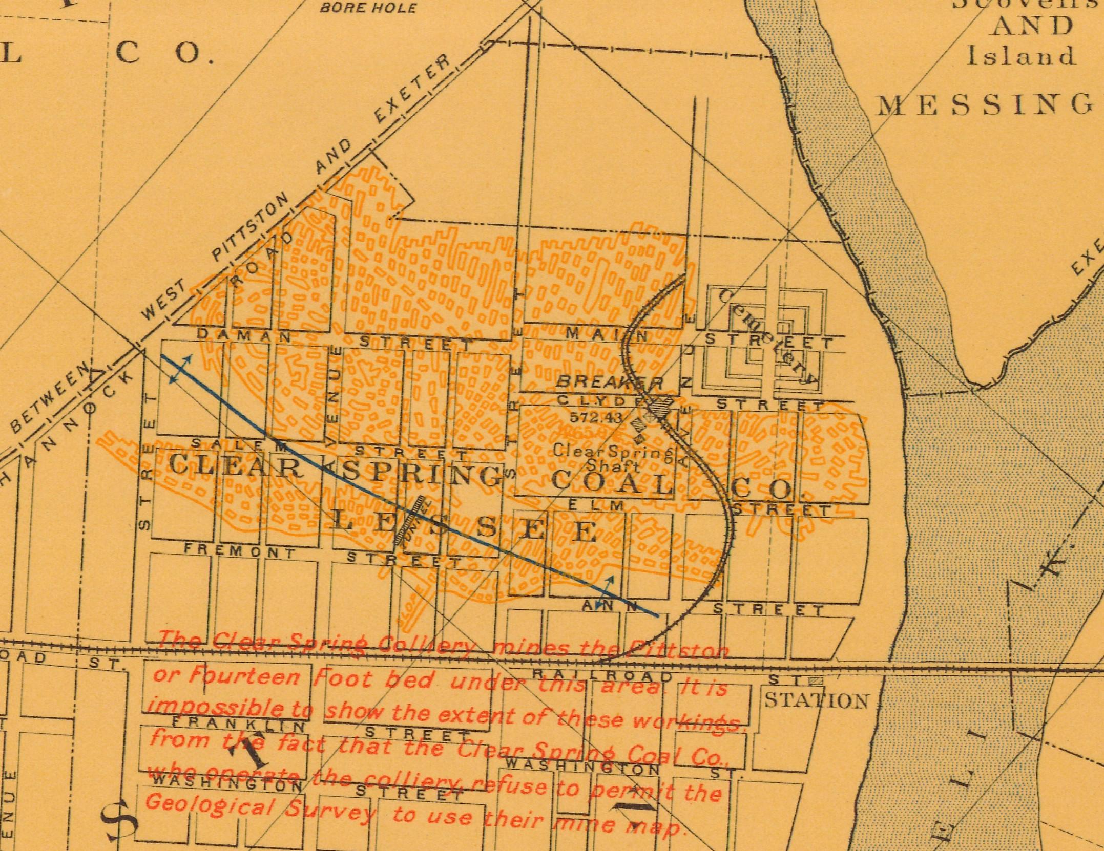
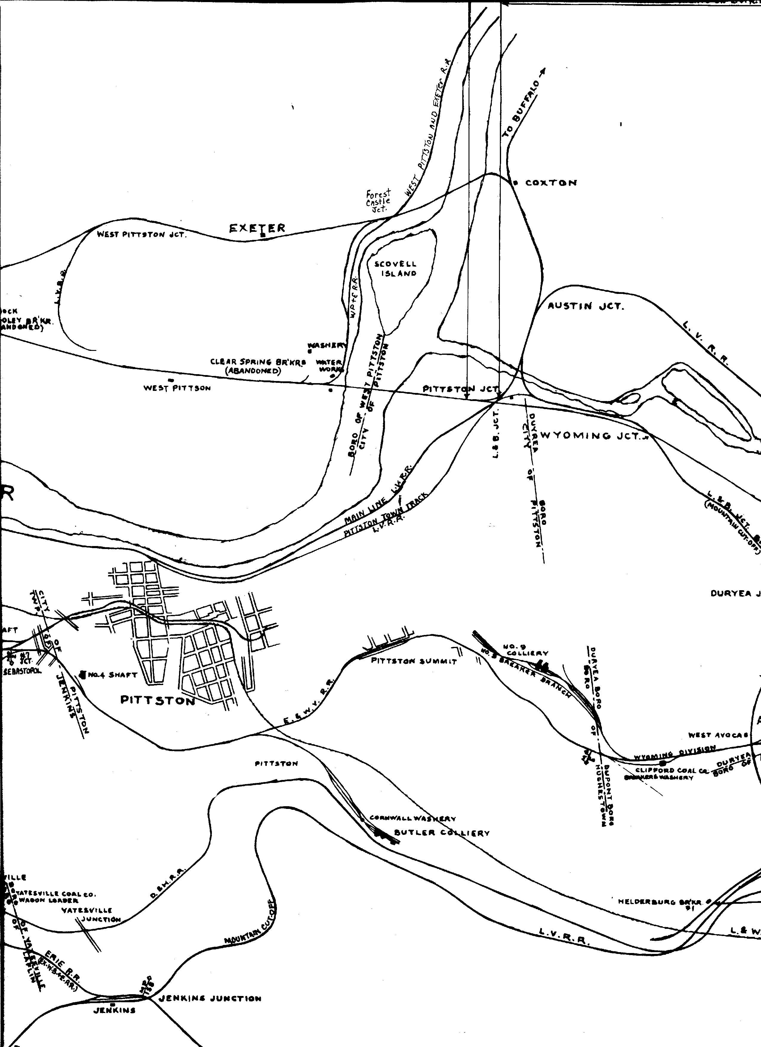
1918 DLW v21b m10
1939 Shepherd Map
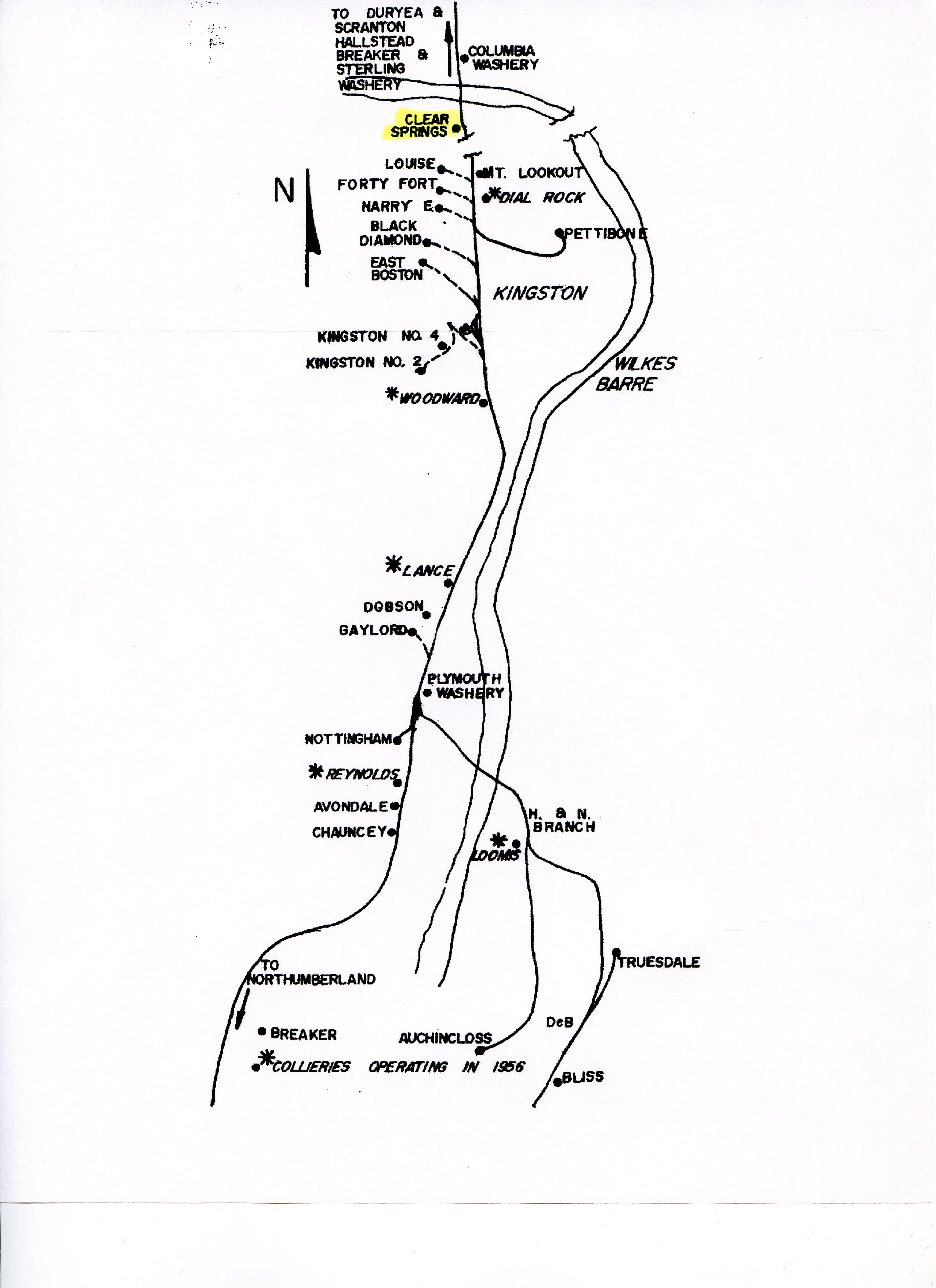
DLW Coal Operations Map
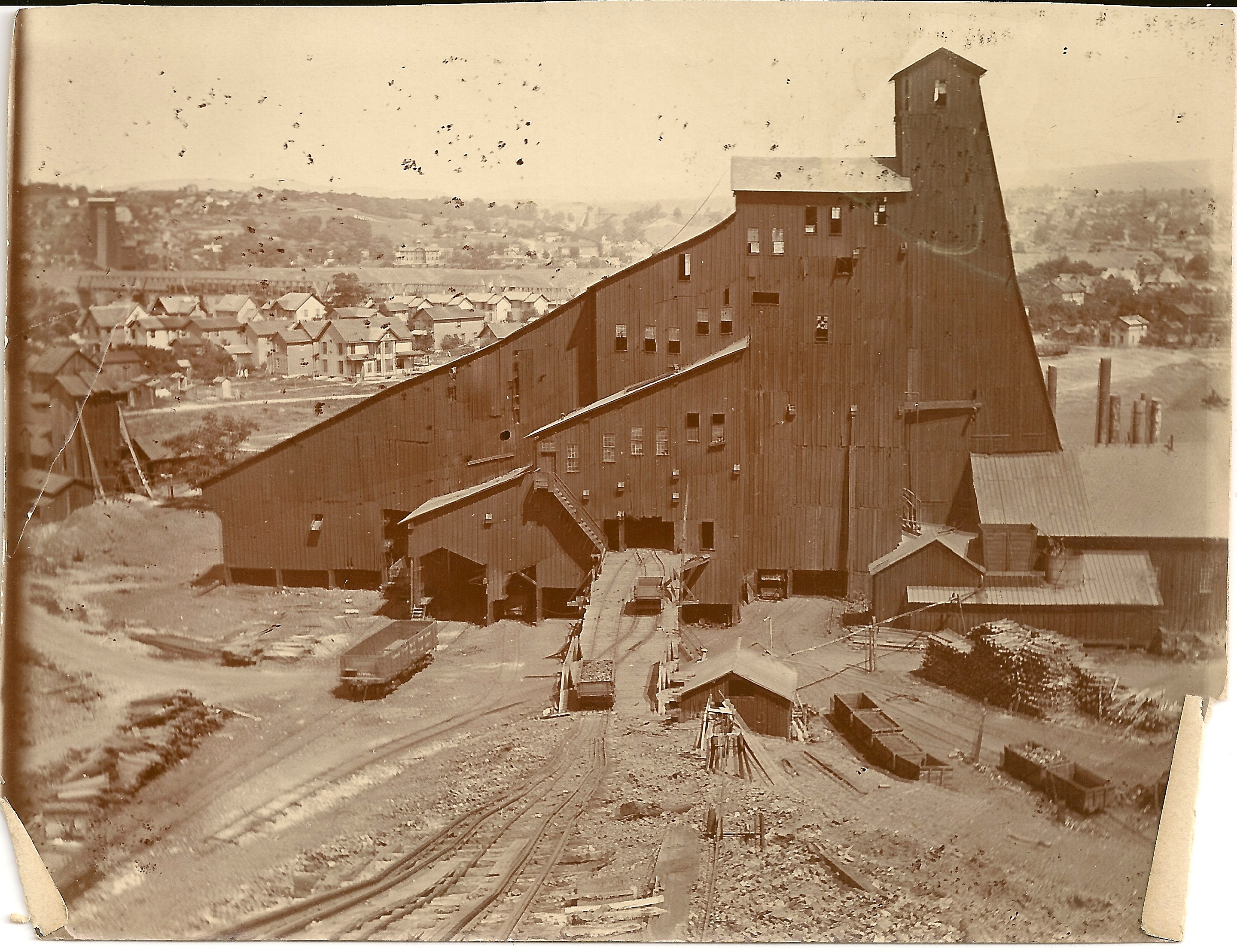
Period Photos
Photo
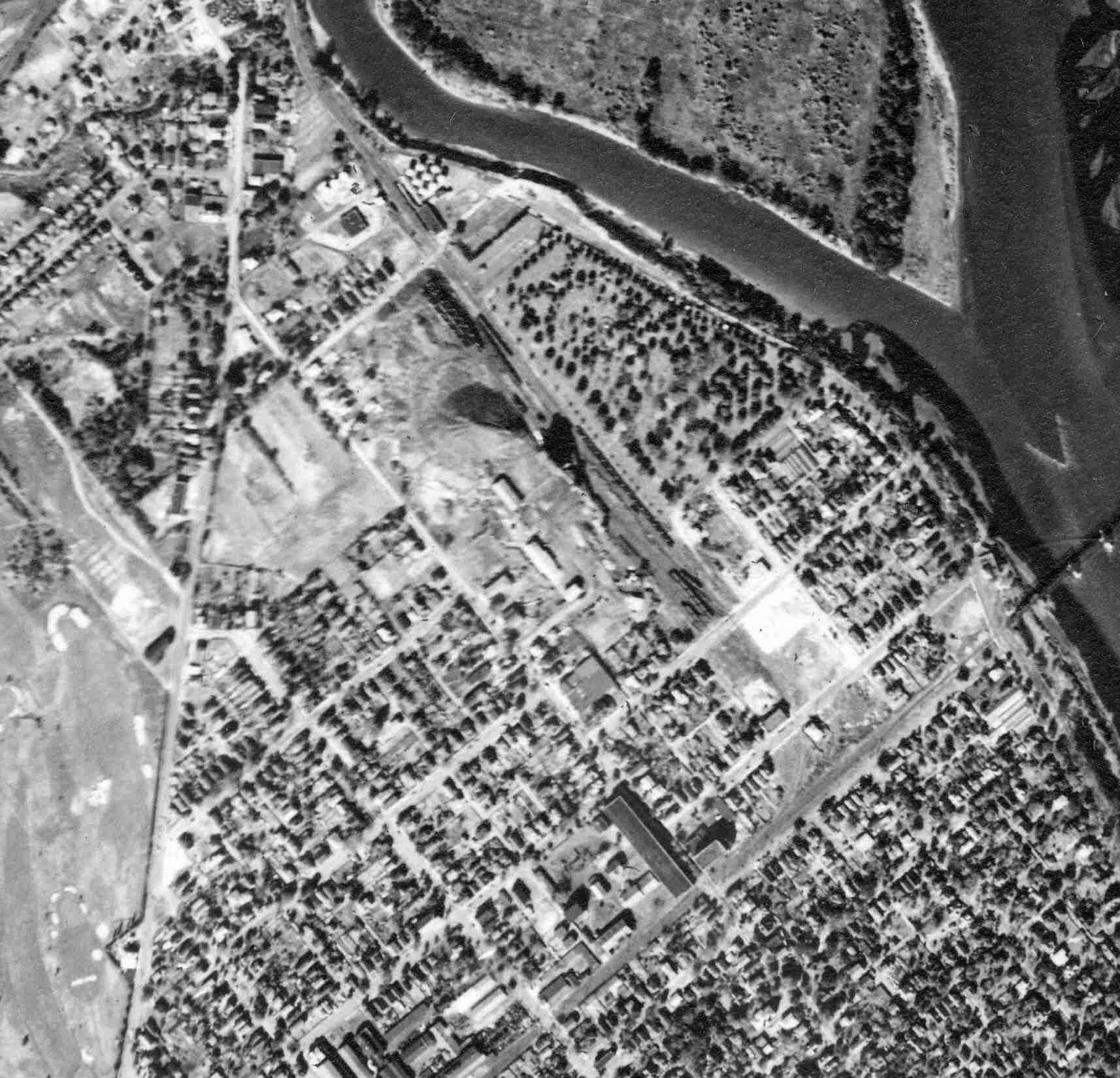
Penn Pilot and Aerial Photos
20_09 date 101038 close-up
Mine Inspections
Inspector Narratives
City & Sanborn Maps
Pittston 1891 Sheet 16
Pittston 1896 Sheet 16
Pittston 1903 Sheet 22
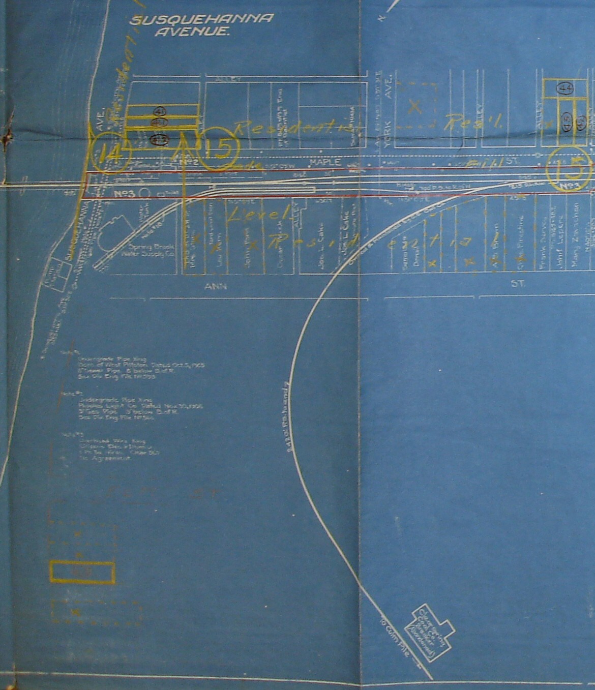
Pittston 1910 Sheet 63
Pittston 1950 Sheet 63
News, History & Articles
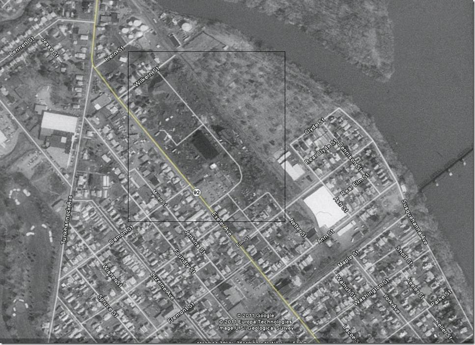
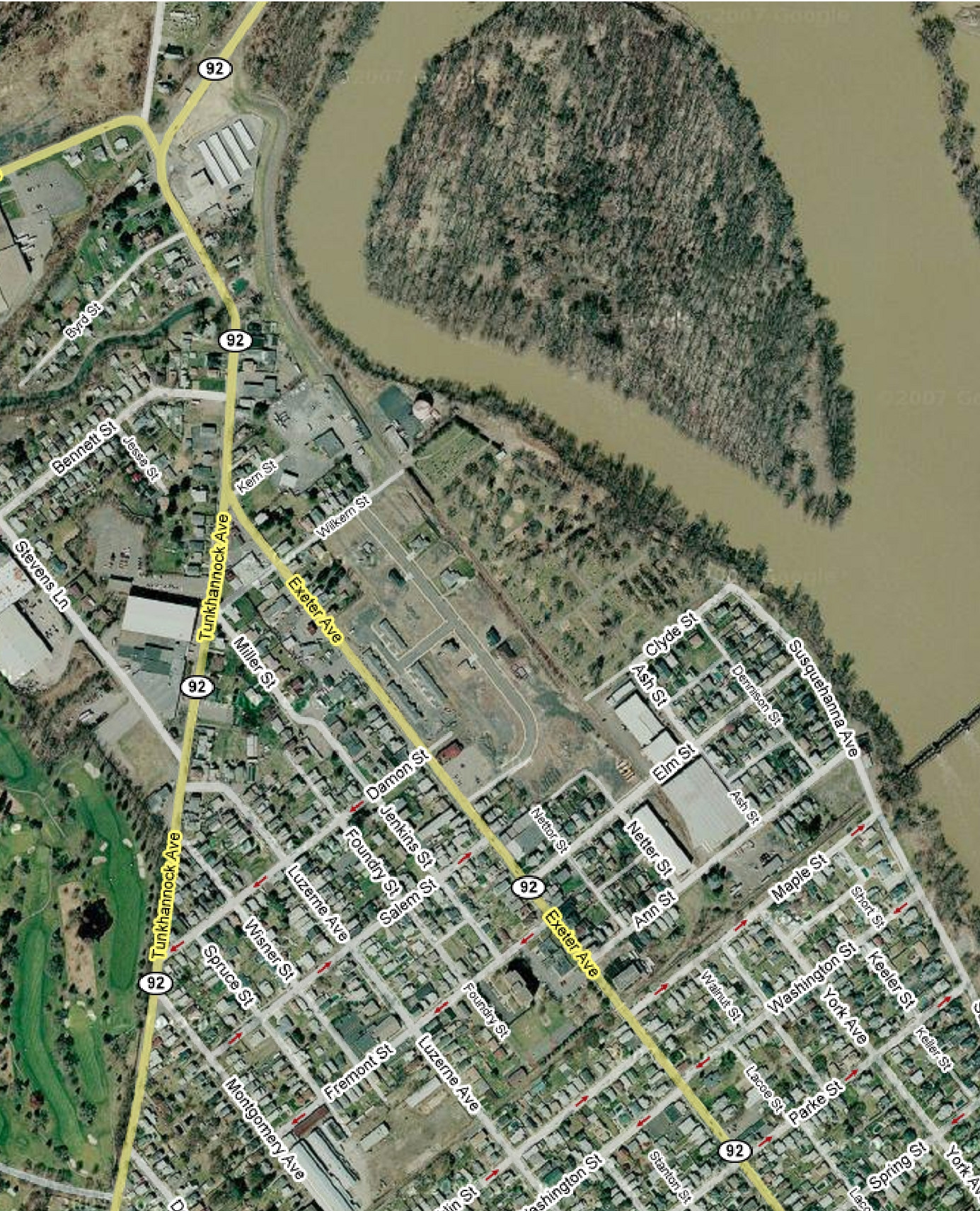
Modern Photos & Google Earth
Clear Springs
Google Earth
Other Materials
Comments and Feedback