Back
Additional information specific to Kenney is not available.
Displaying information for the correlated Gravity Slope operation instead.
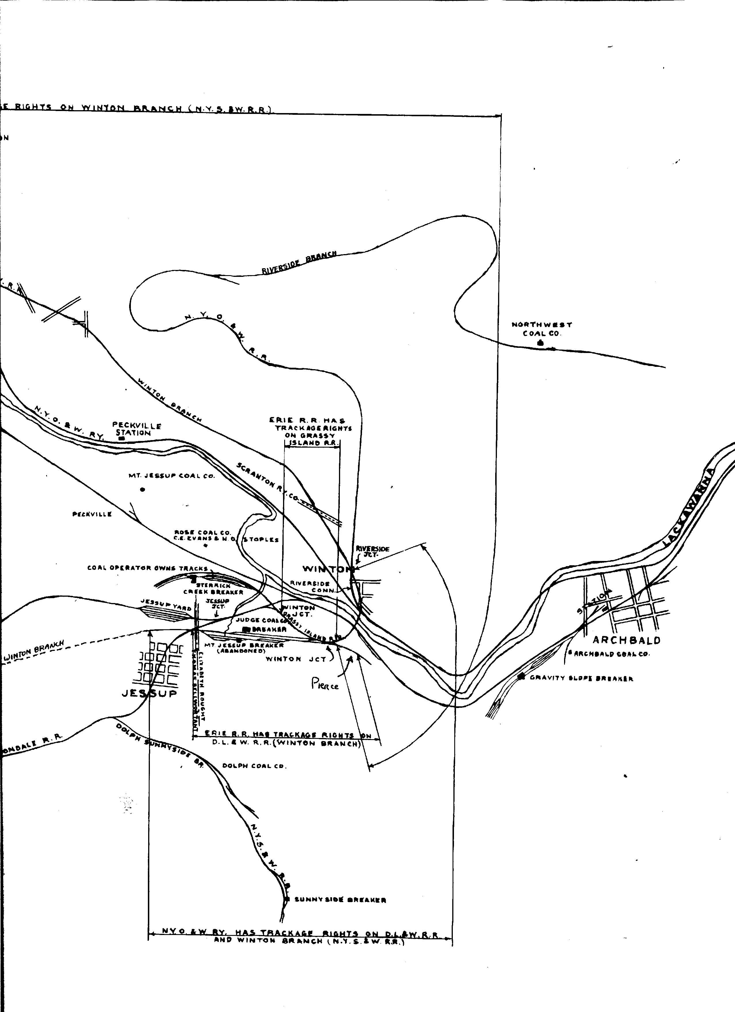
Area & Railroad Maps
1878 Mine Inspector Map
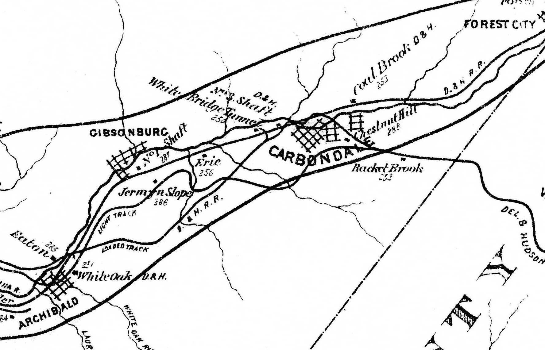
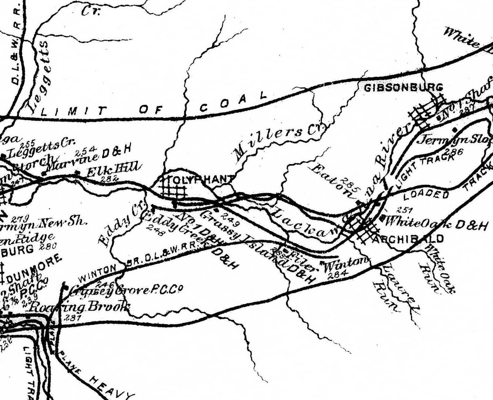
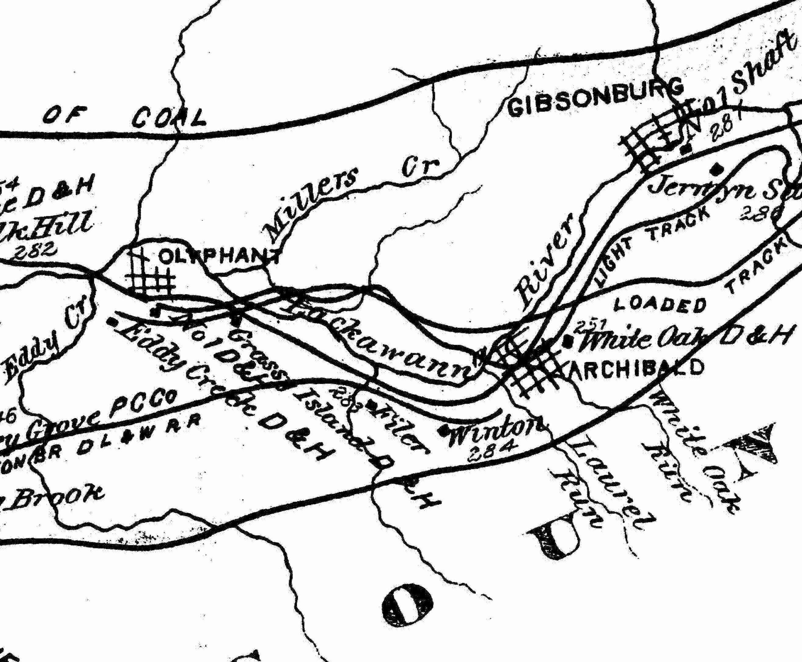
1879 Mine Inspector Map
1880 Mine Inspector Map
1888 2nd Pa Geo Survey sheet XX
1890 Northern Field Map (20) PSU
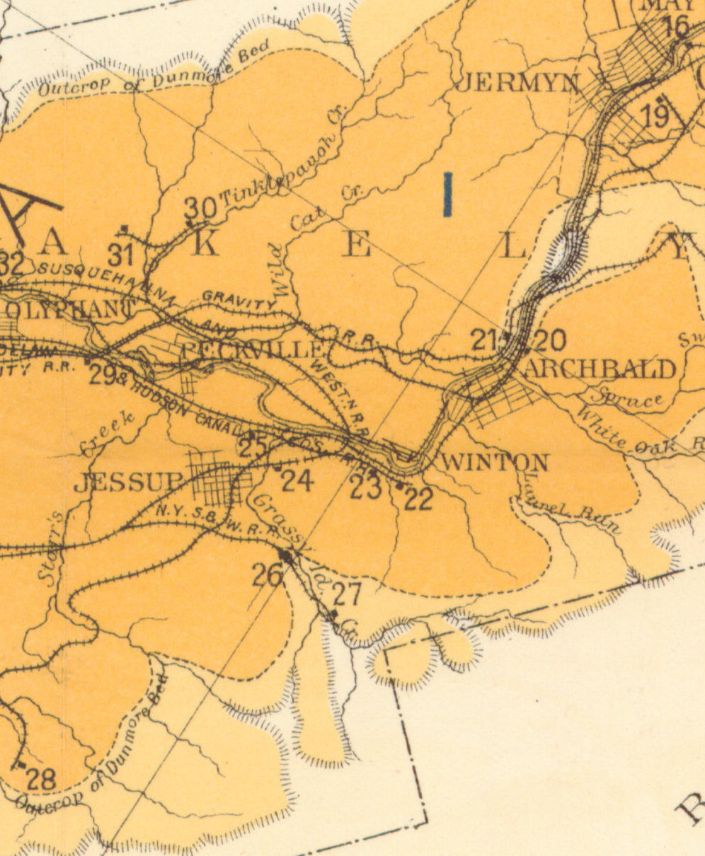
1894 Baist Atlas Wyoming and Lackawanna Valley Plate 11
1918 DH v2a m09
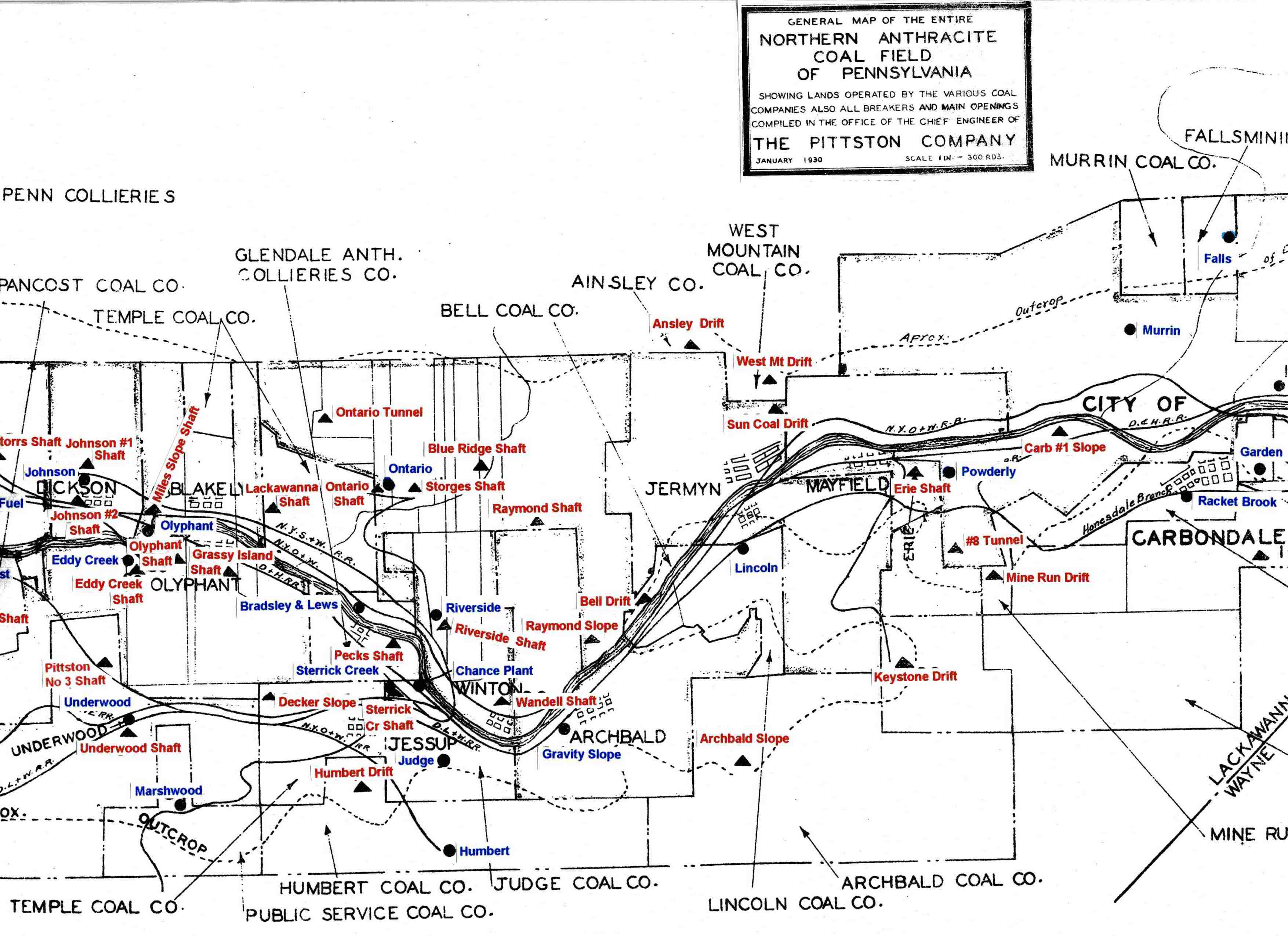
1930 Pittston Co Map
1939 Shepherd Map
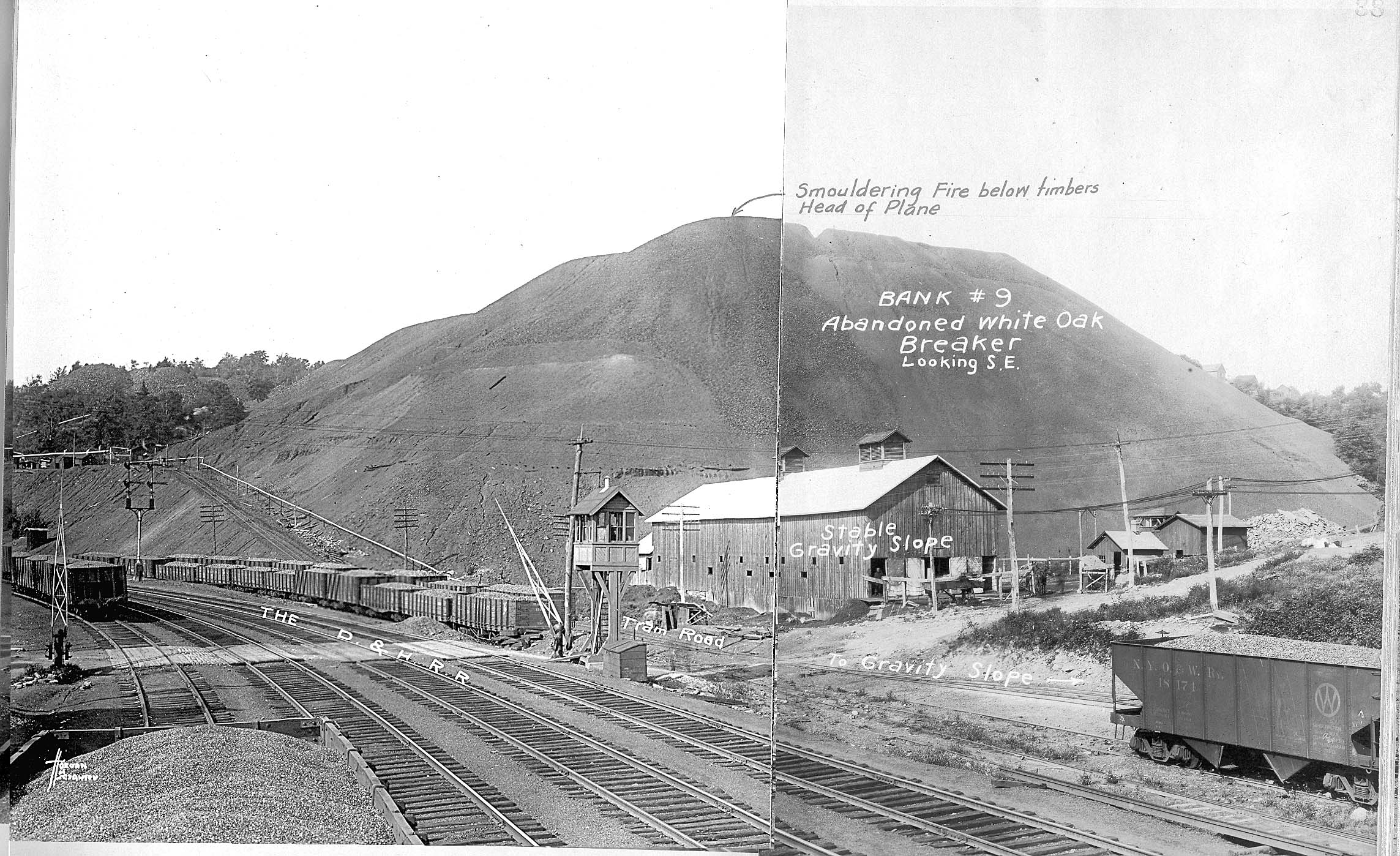
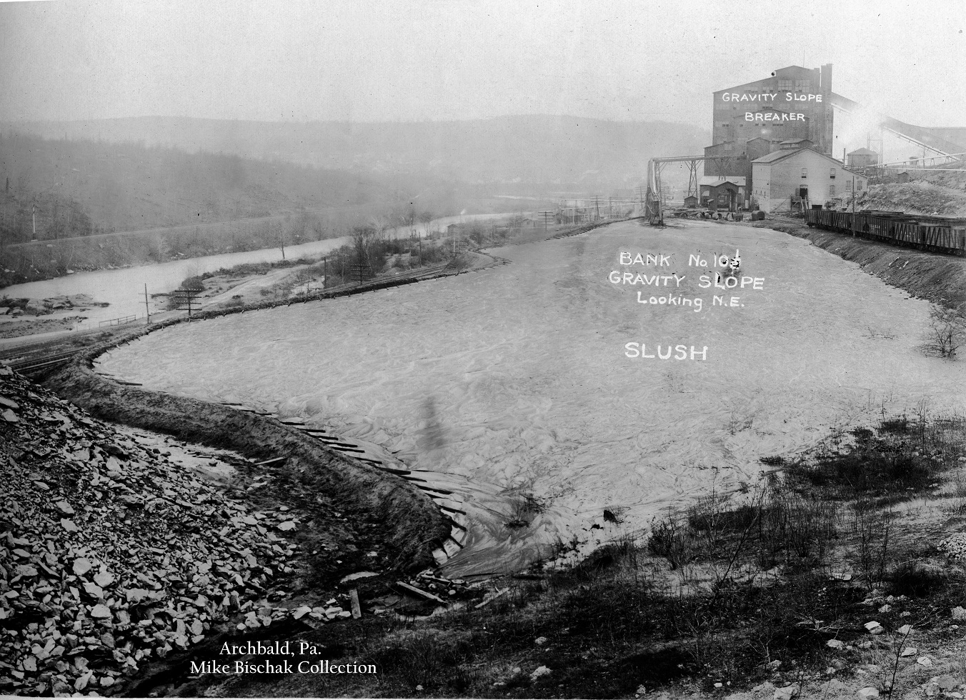
Period Photos
3 photos
3 photos
3 photos
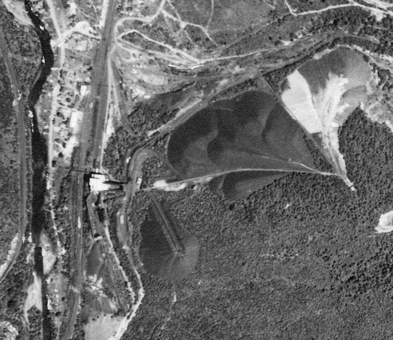
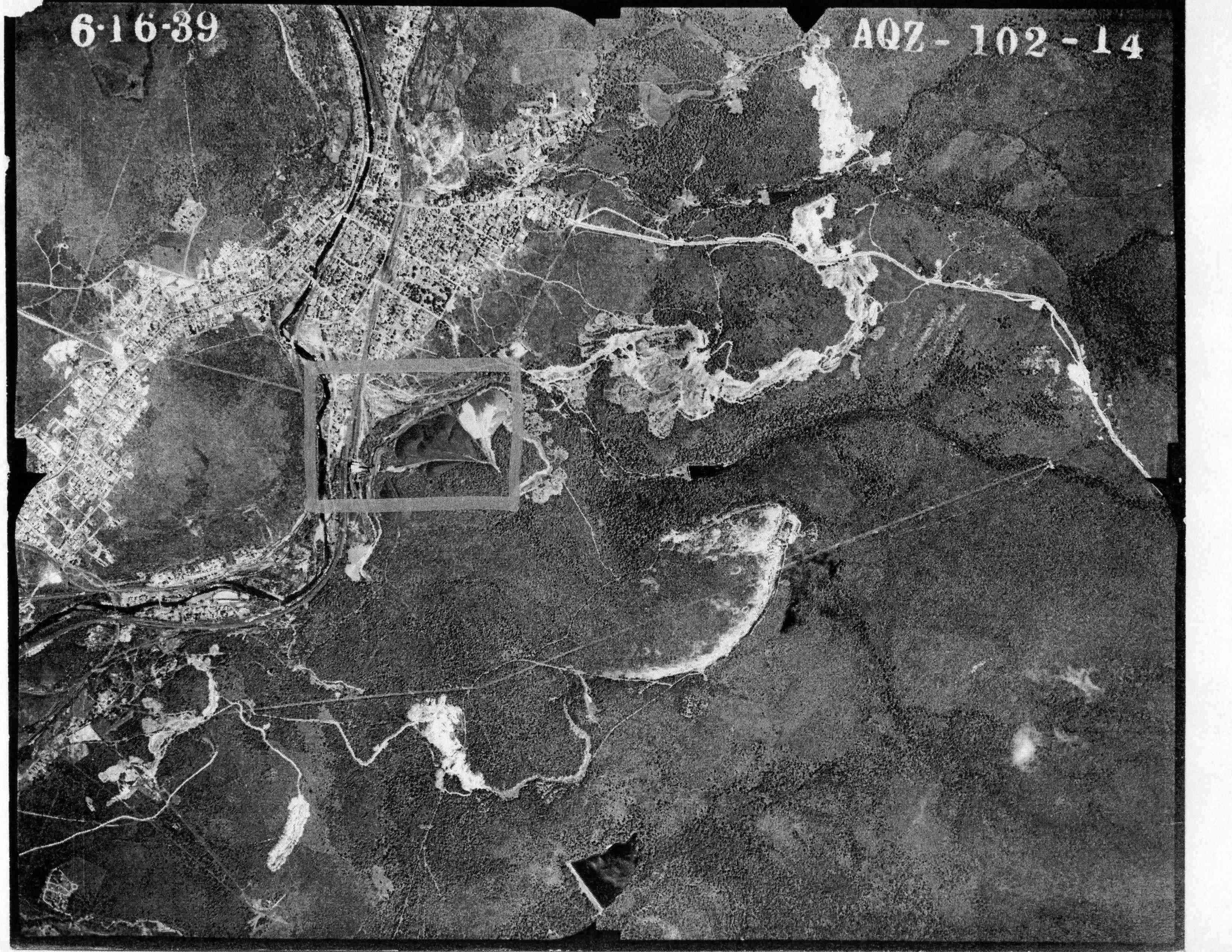
Penn Pilot and Aerial Photos
102_14 date 061639 close-up
Slope 102_14 date 061639
Mine Inspections
Inspector Narratives
City & Sanborn Maps
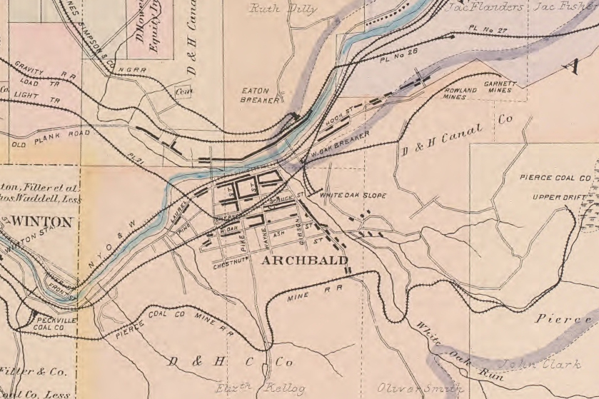
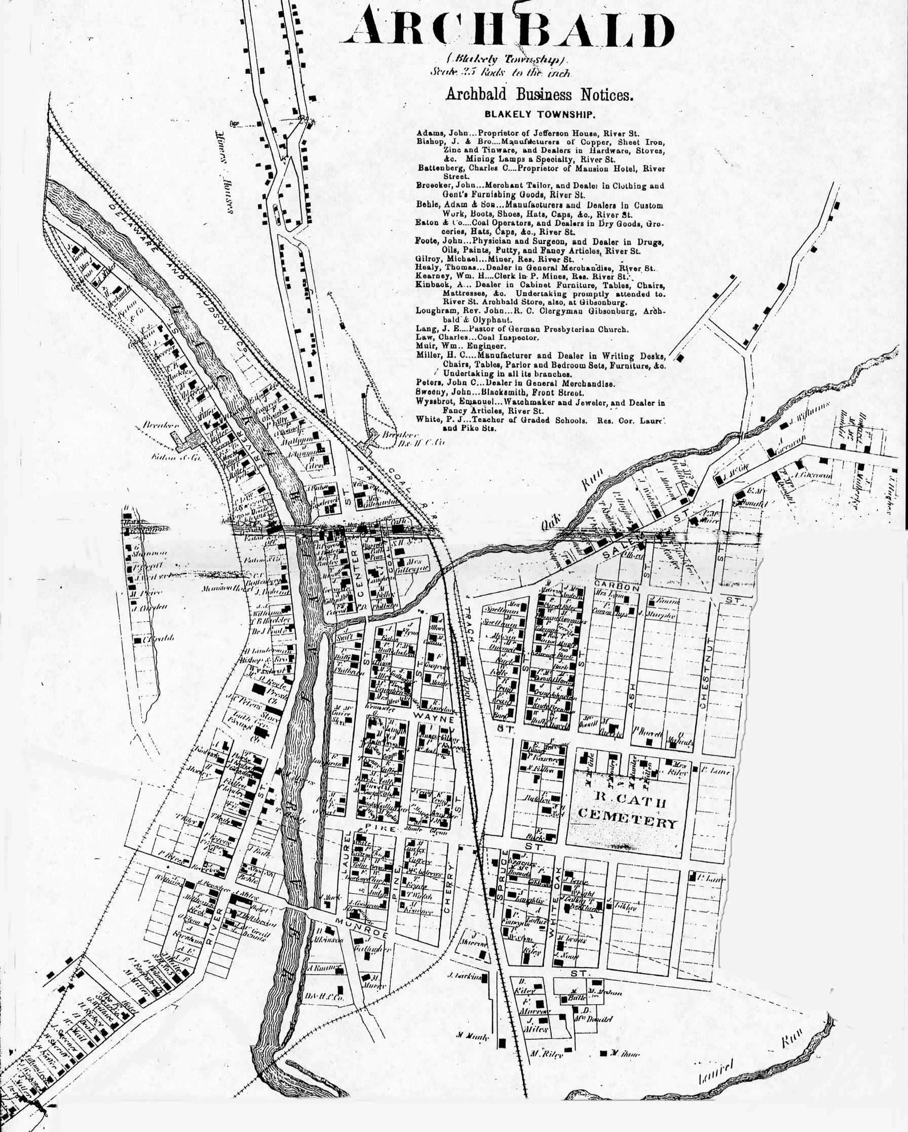
1873 Archbald Map
Scranton Suburbs 1925 Sheet 10
Scranton Suburbs 1949 Sheet 10
Scranton Suburbs 1956 Sheet 10
News, History & Articles
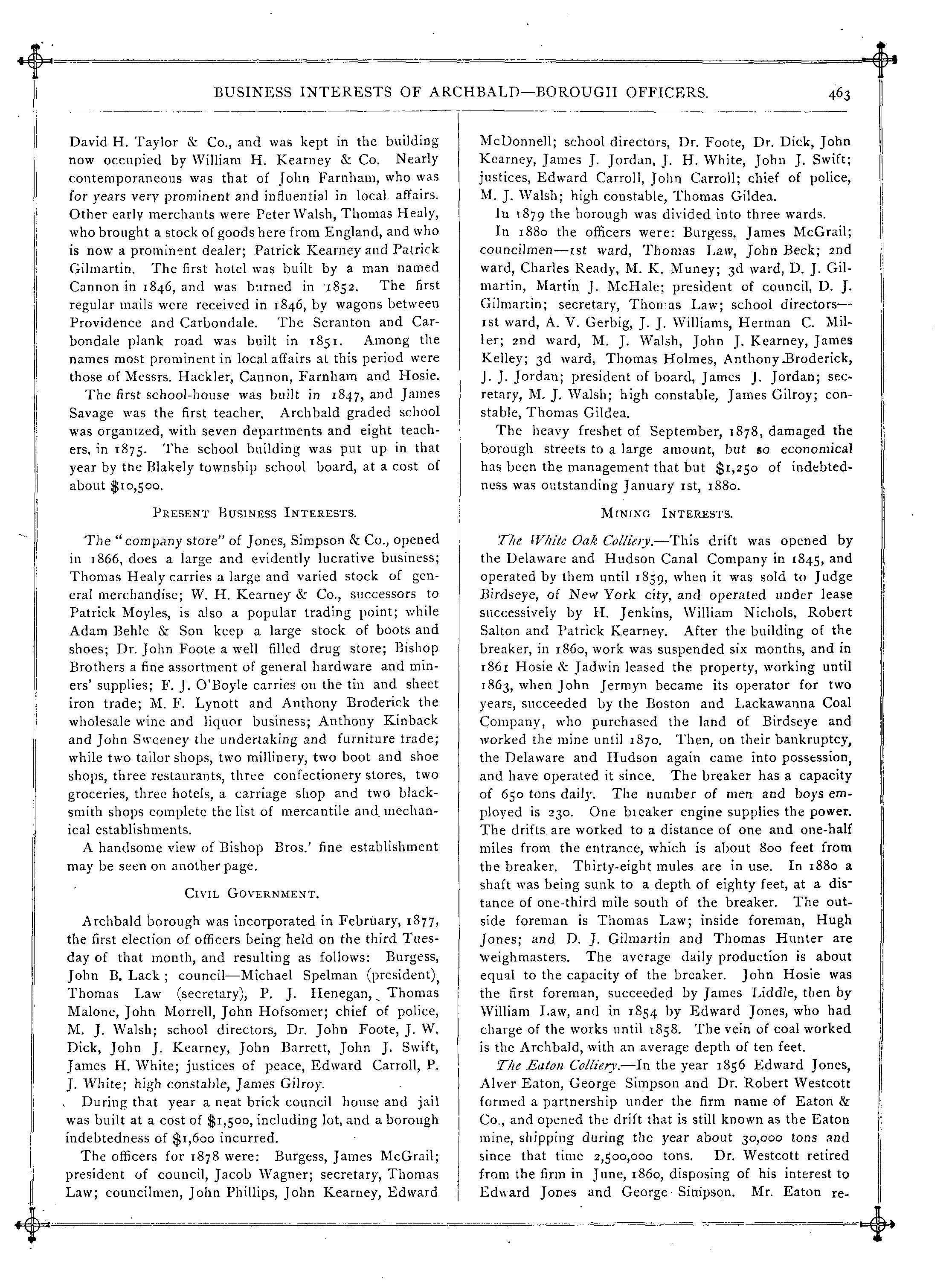
1880 History p 463
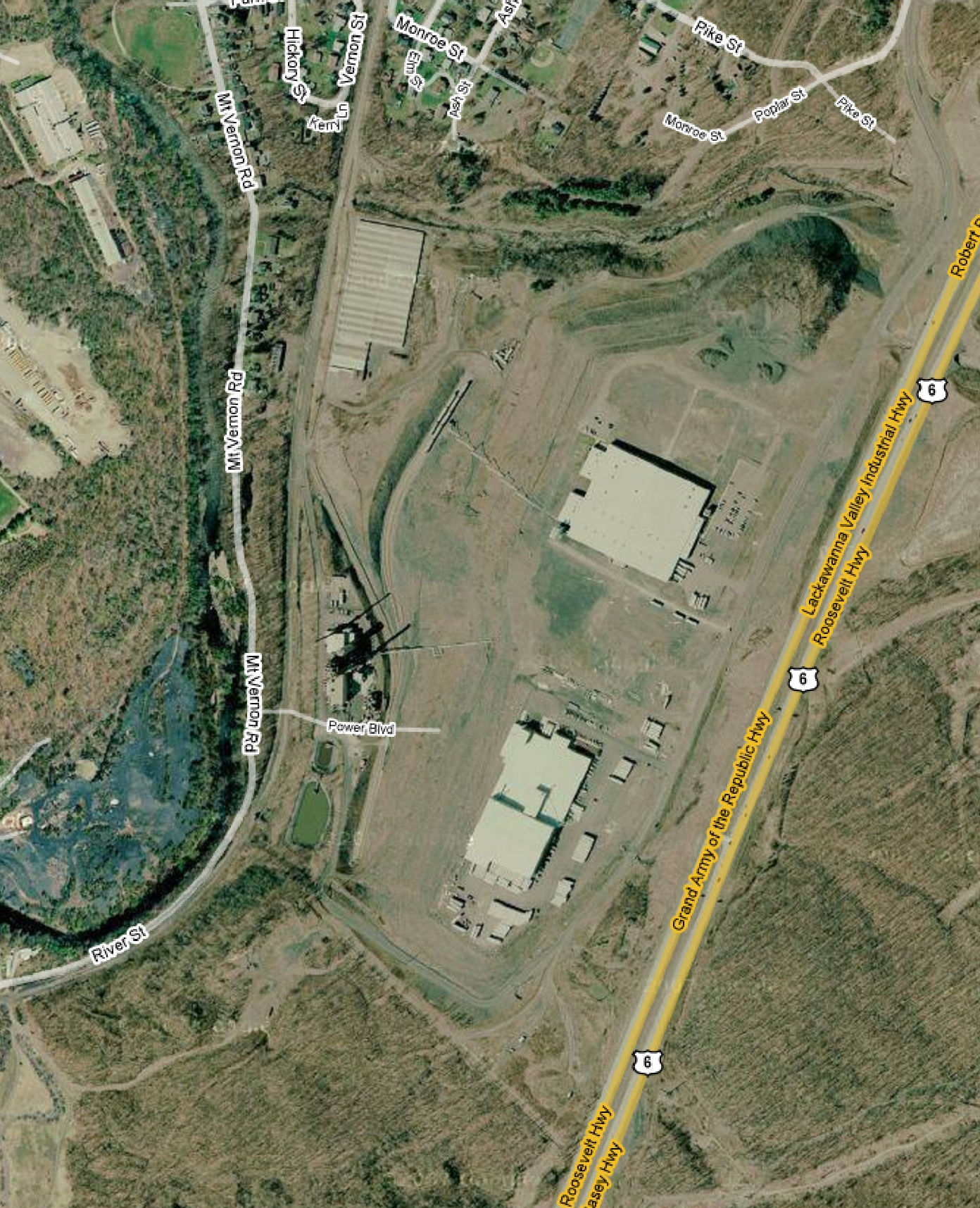
Modern Photos & Google Earth
Google Earth
Other Materials
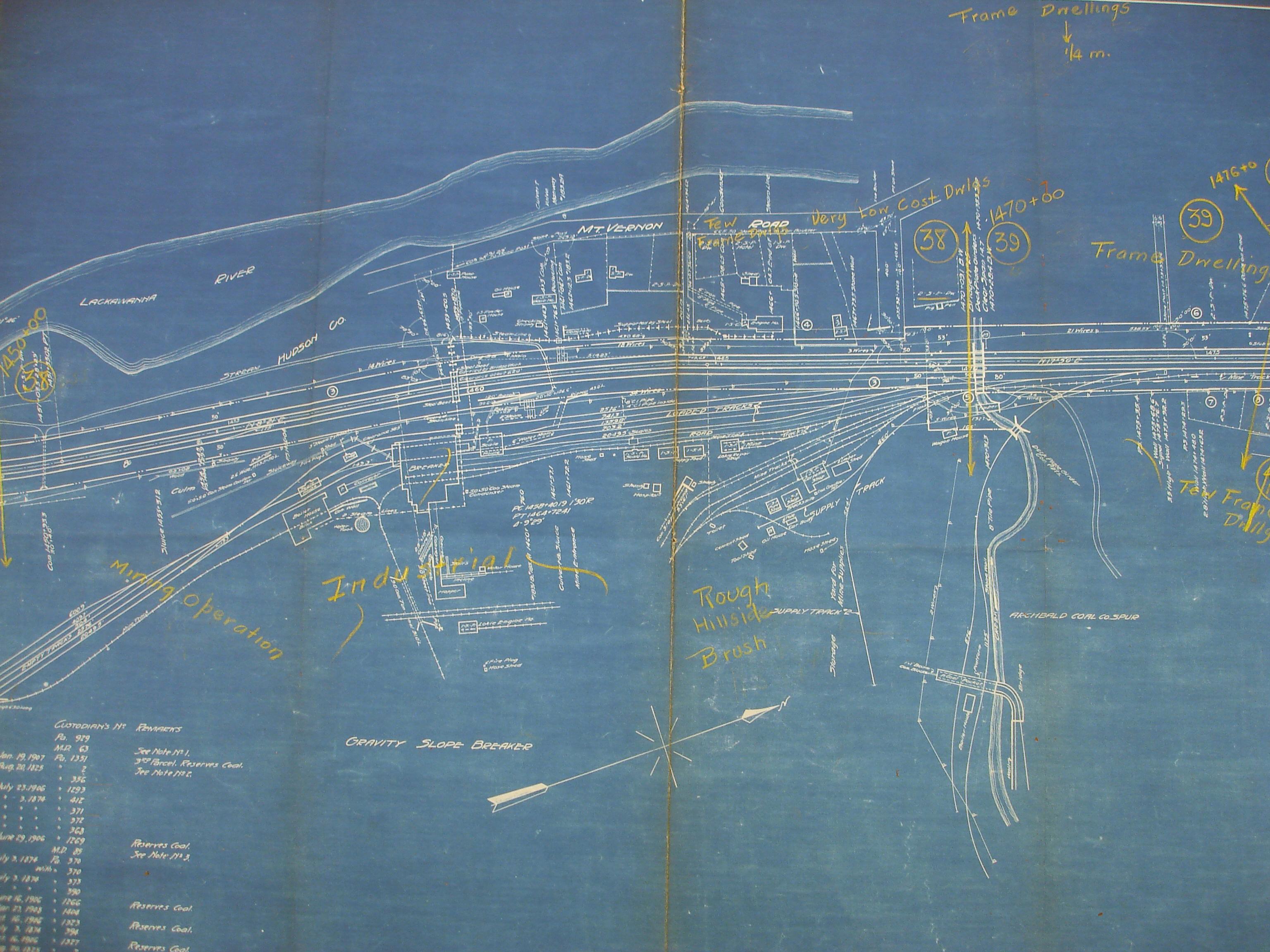
1930 DH Coal Operations CY
Archbald History
Comments and Feedback