Back
Additional information specific to Green Top is not available.
Displaying information for the correlated Marshwood operation instead.
Area & Railroad Maps
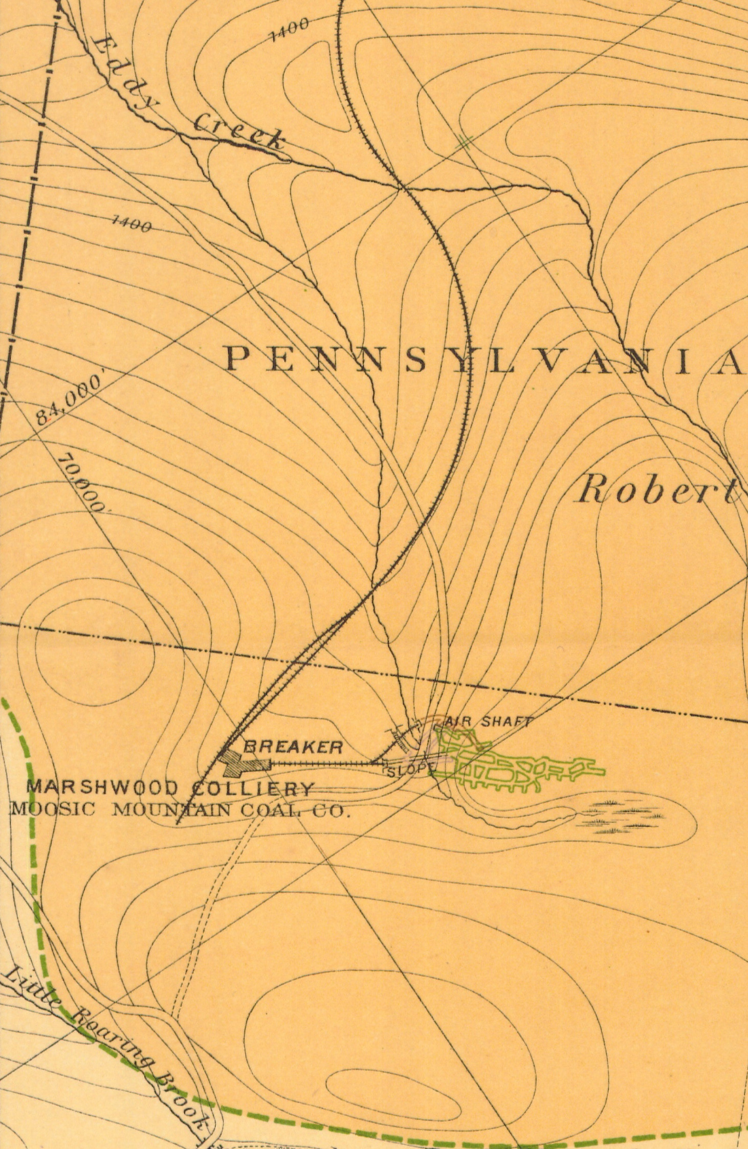
1888 2nd Pa Geo Survey sheet XVIII
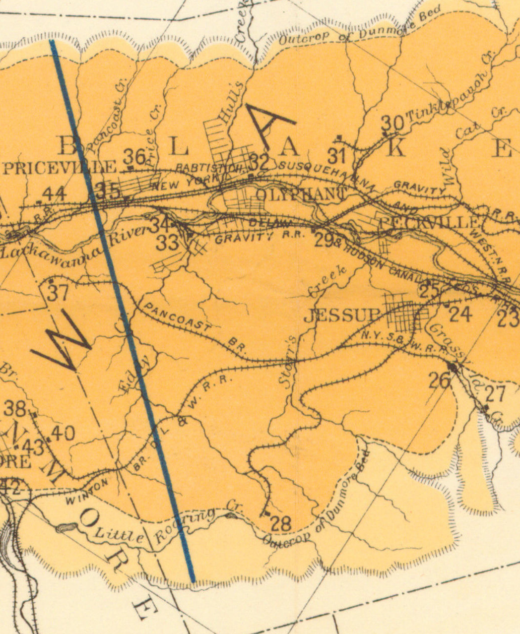
1890 Northern Field Map (28) PSU
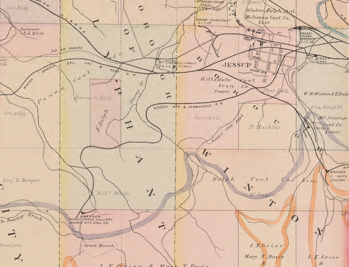
1894 Baist Atlas Wyoming and Lackawanna Valley Plate 11
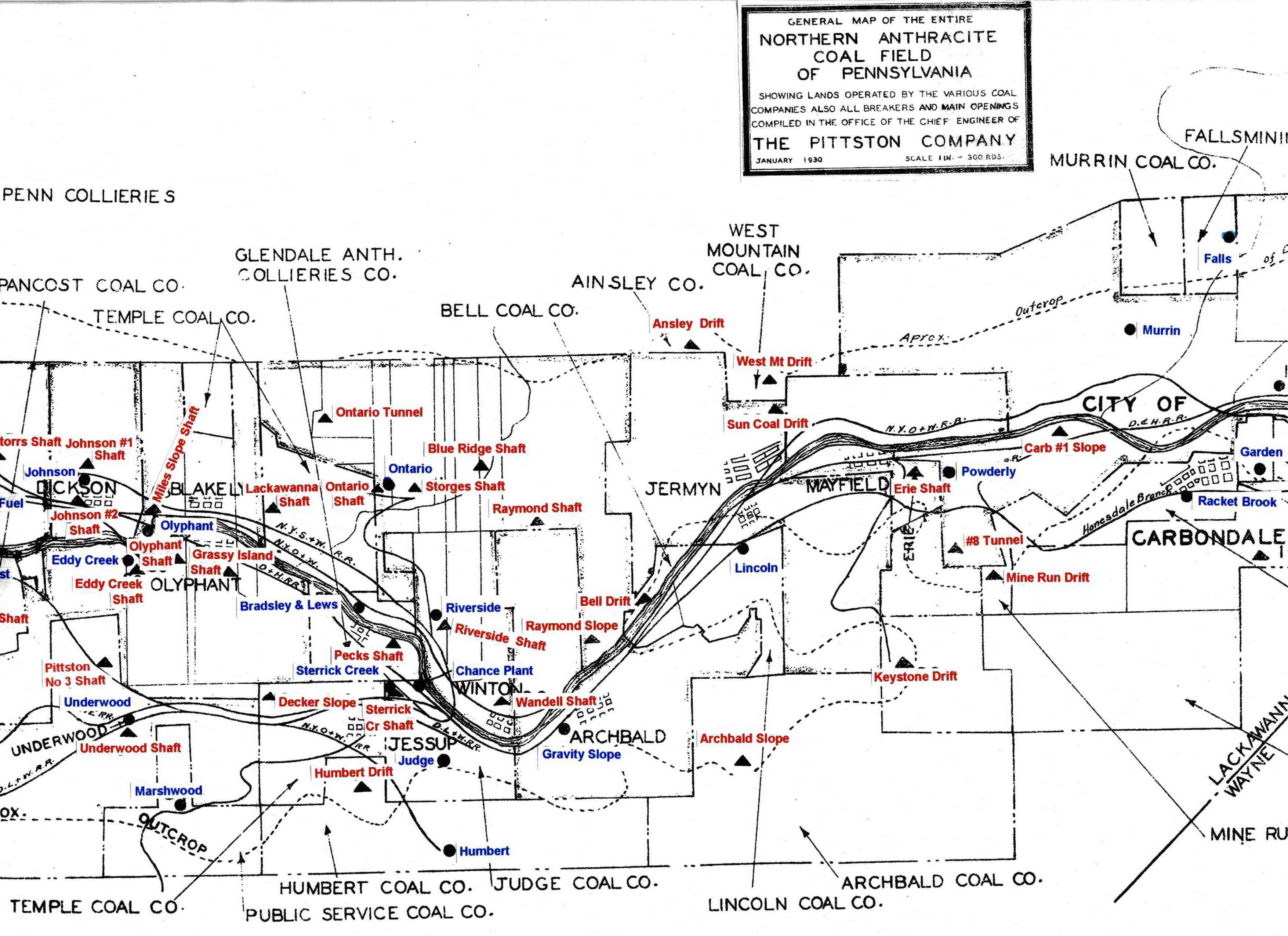
1930 Pittston Co Map
1932 Erie RR Sketch Dunmore and Jessup
DLW Coal Operations
Period Photos
Penn Pilot and Aerial Photos
102_16 date 061639 close-up
102_16 date 061639
Mine Inspections
Inspector Narratives
City & Sanborn Maps
News, History & Articles
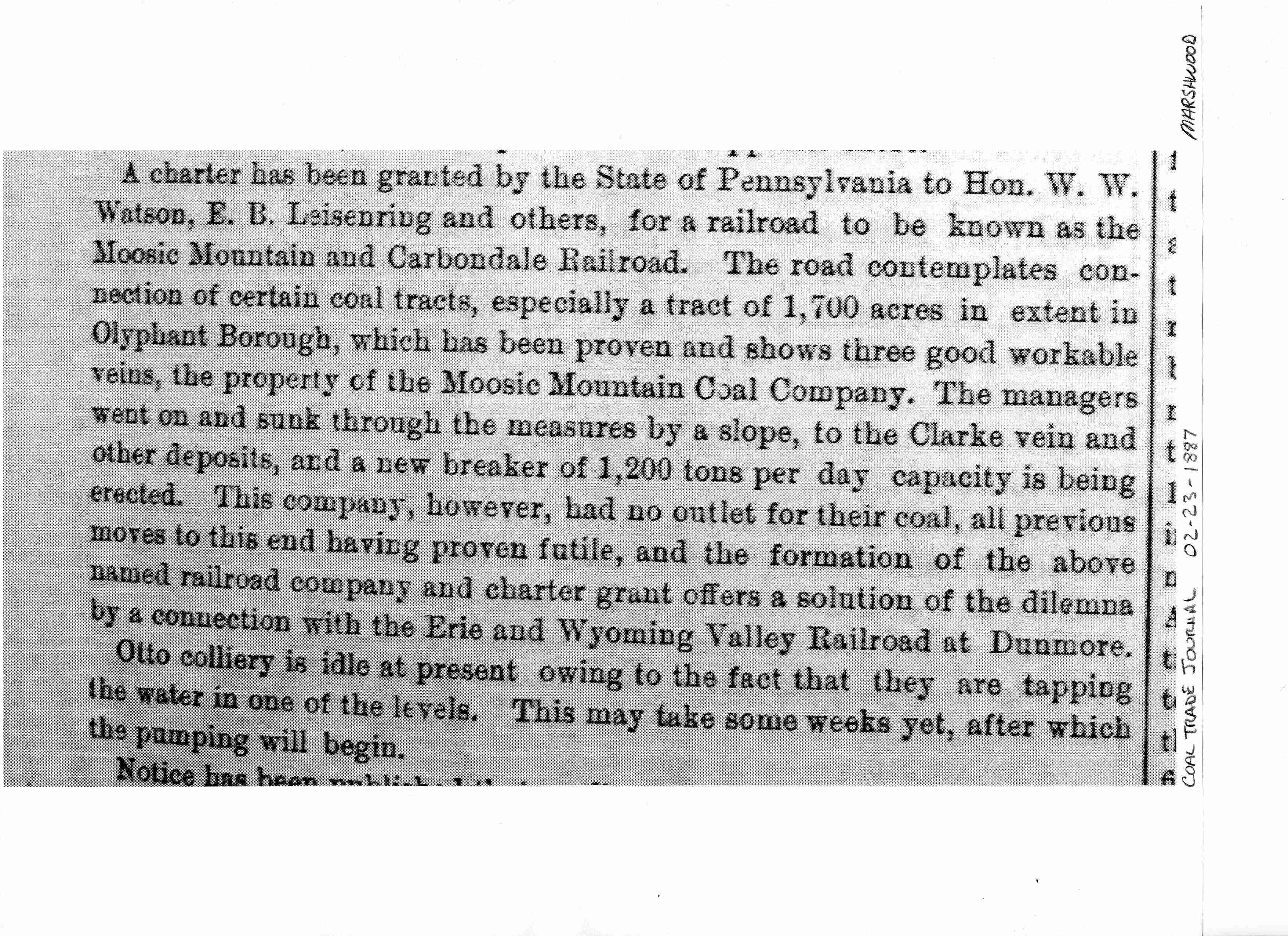
1887-02-23 CTJ JG
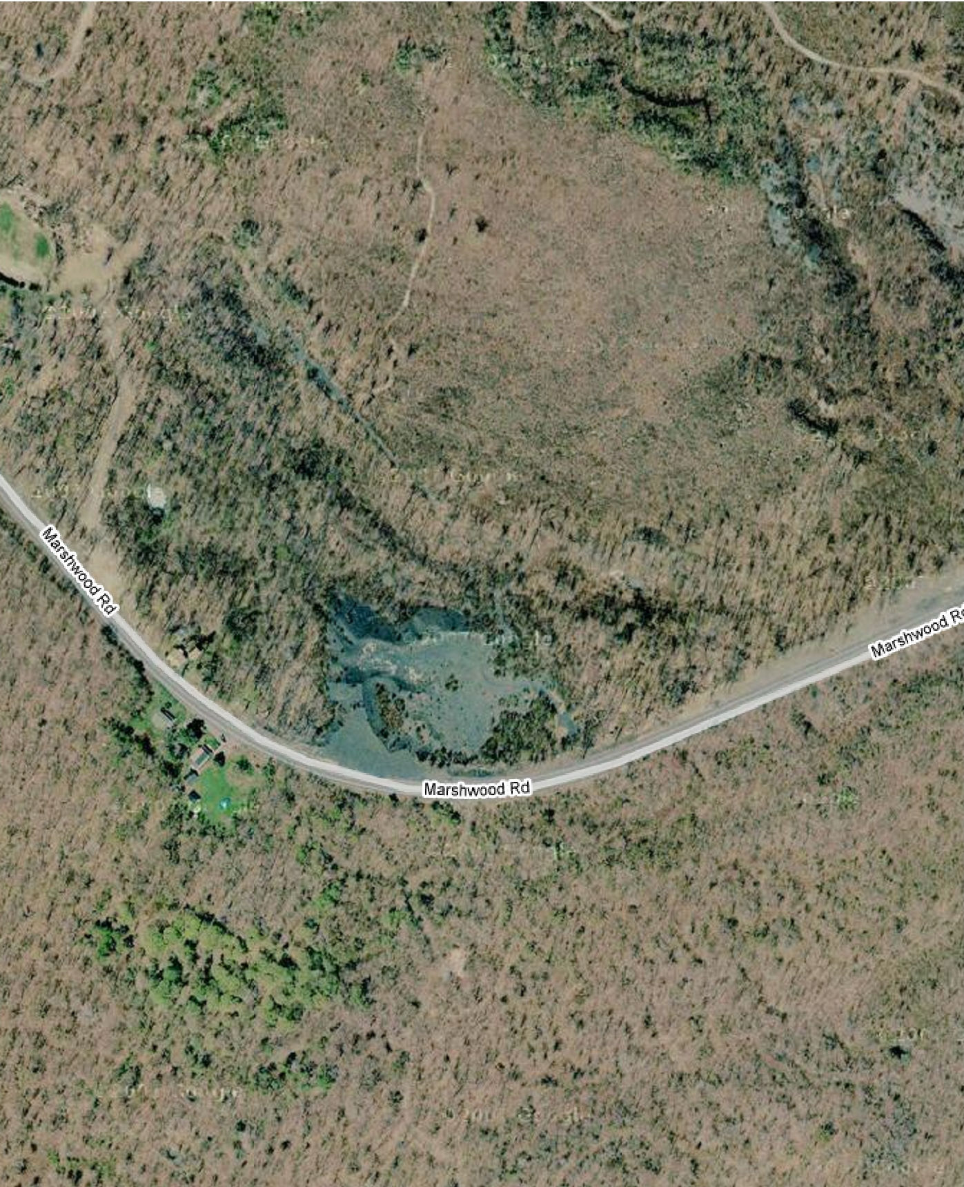
Modern Photos & Google Earth
Google Earth
Other Materials
Comments and Feedback