Back
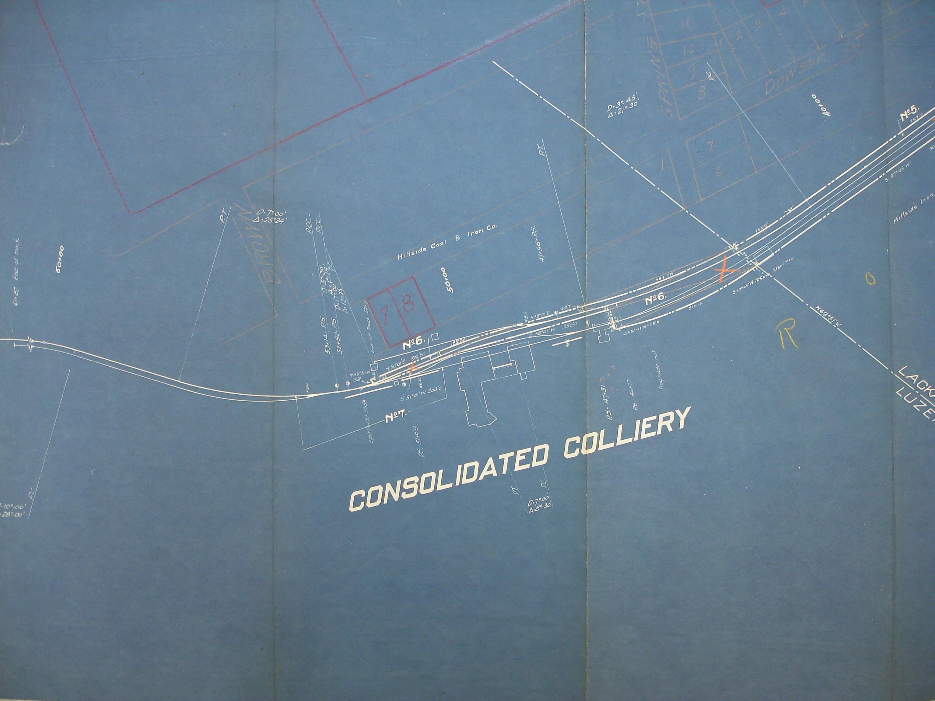
Consolidated
Area & Railroad Maps
1887 2nd Pa Geo Survey sheet XII
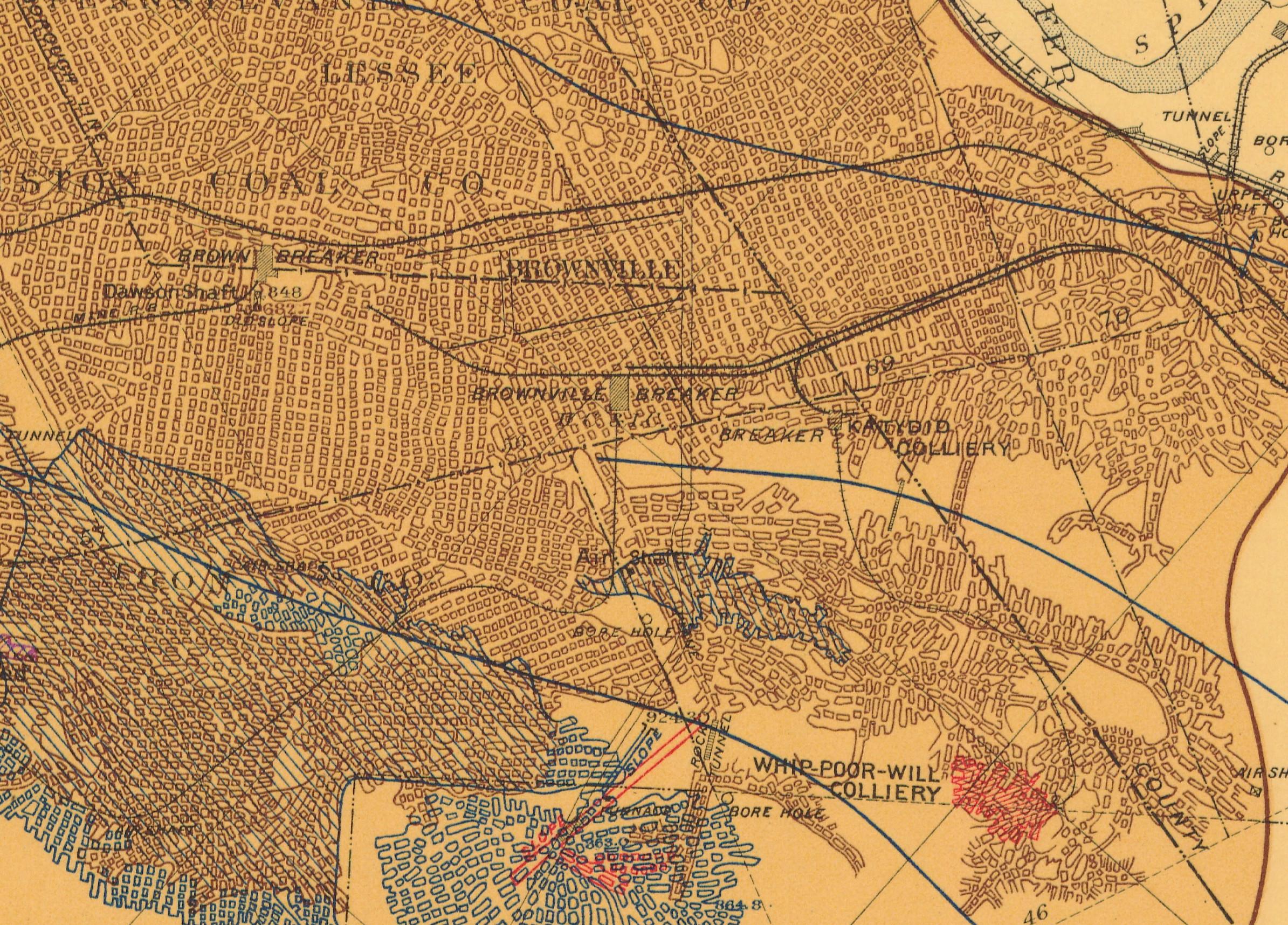
1890 Northern Field (89) PSU
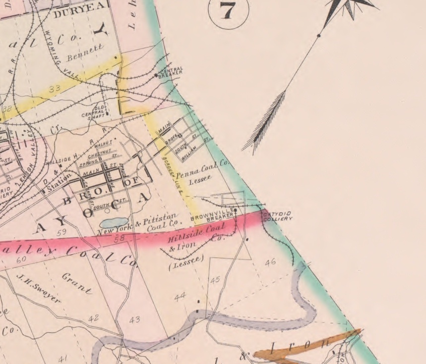
1894 Baist Atlas Wyoming & Lackawanna Valley Plate 5
1918 Erie v4 Pa m57
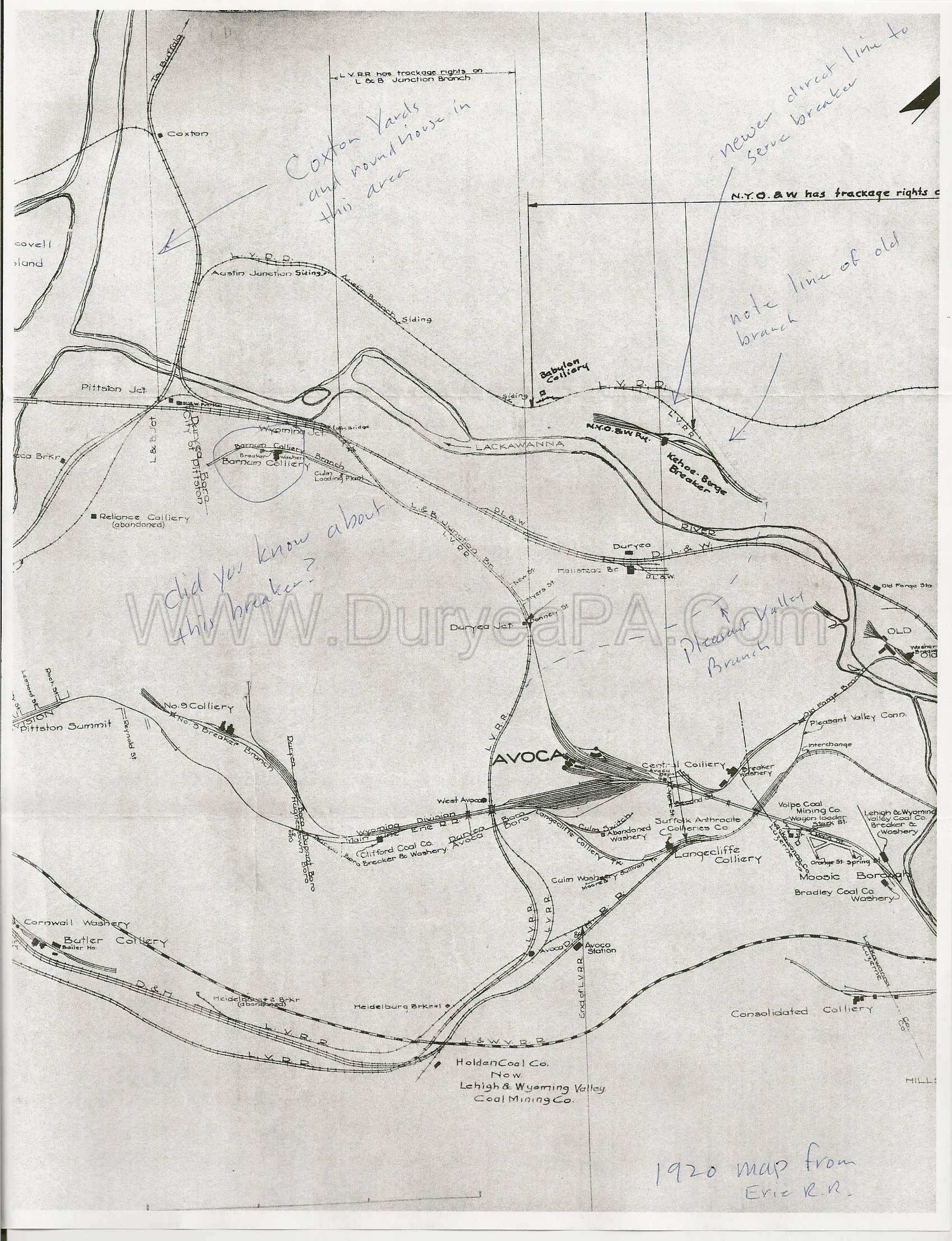
1920 Erie map
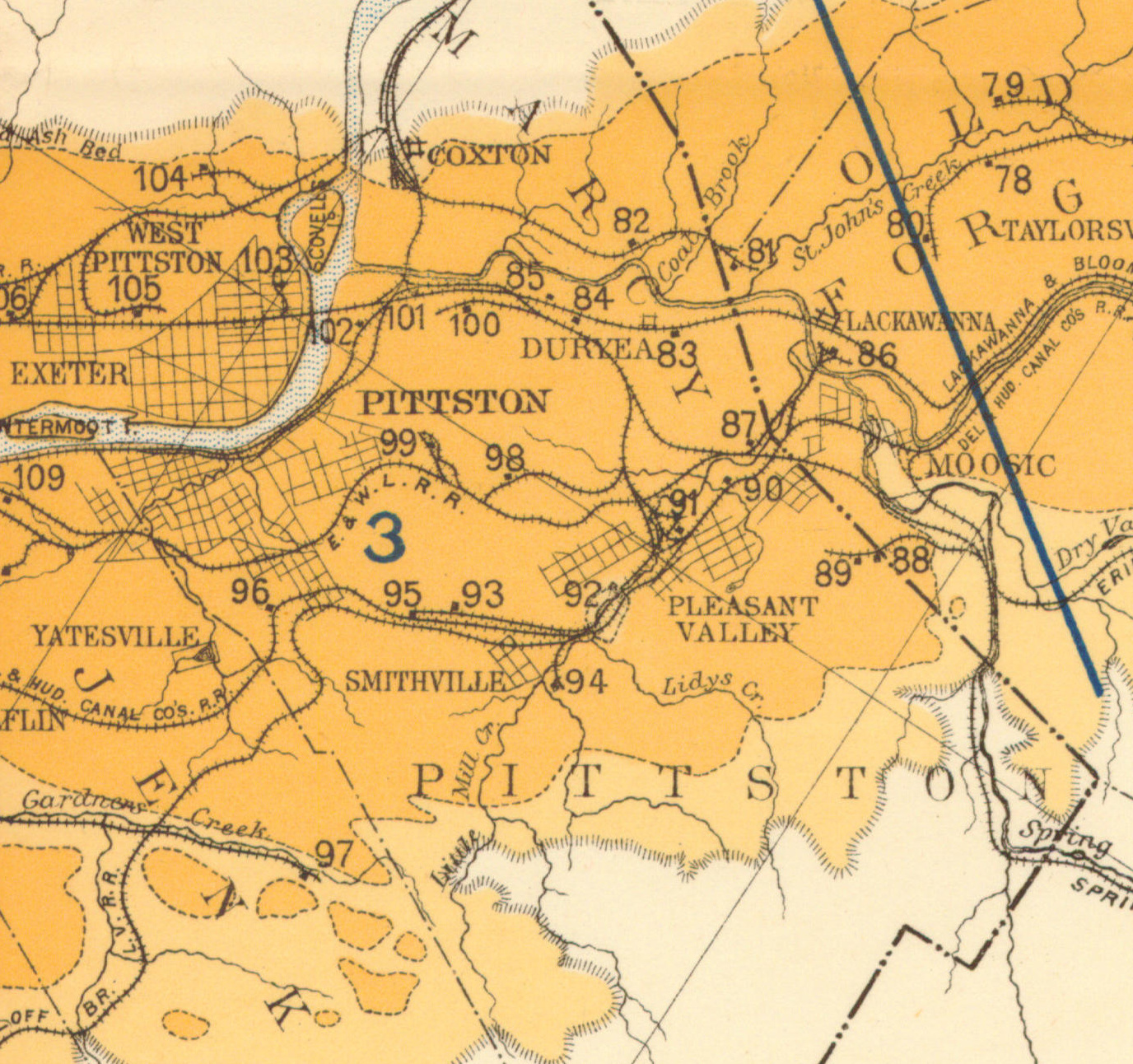
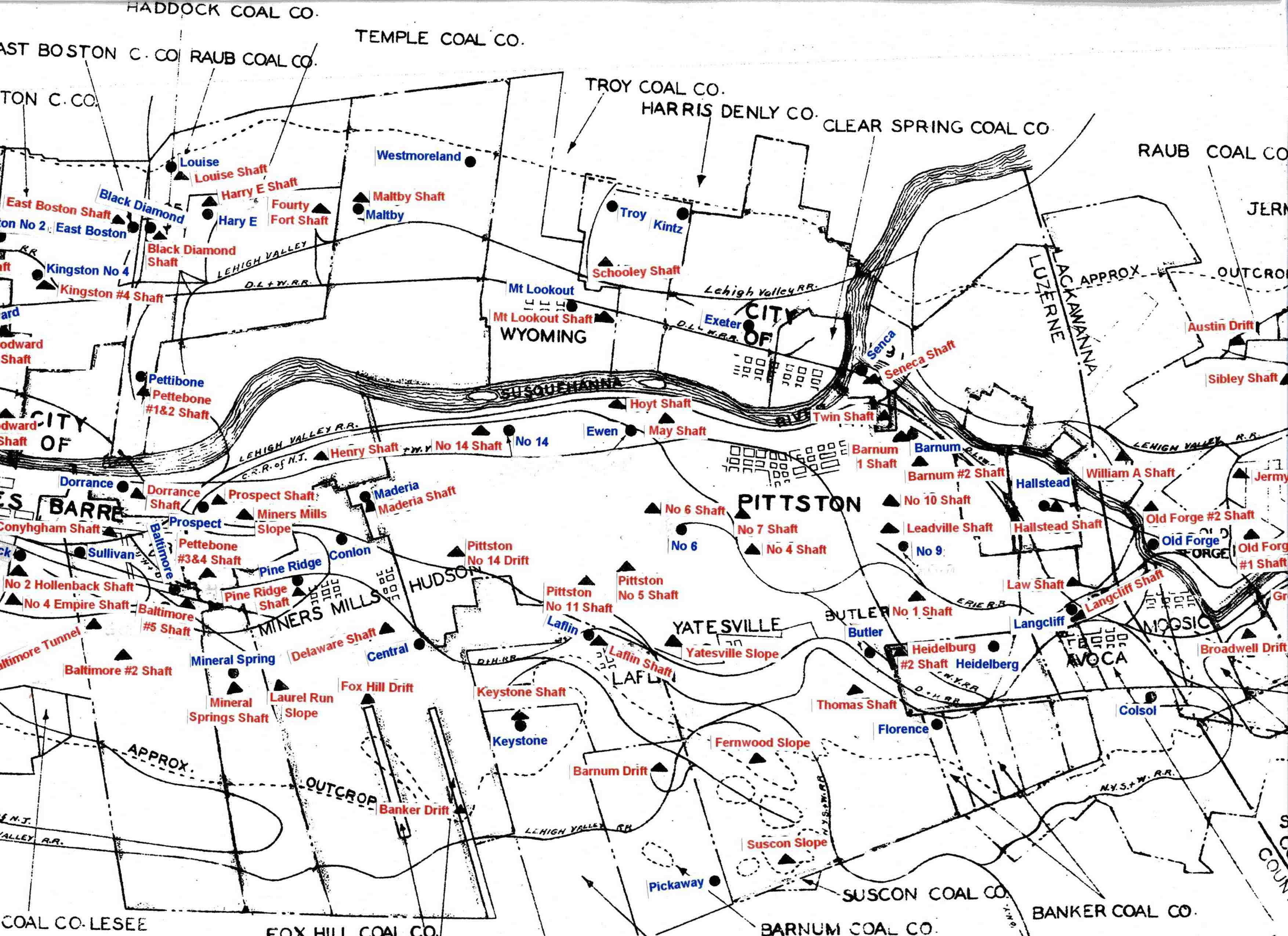
1930 Pittston Co Map
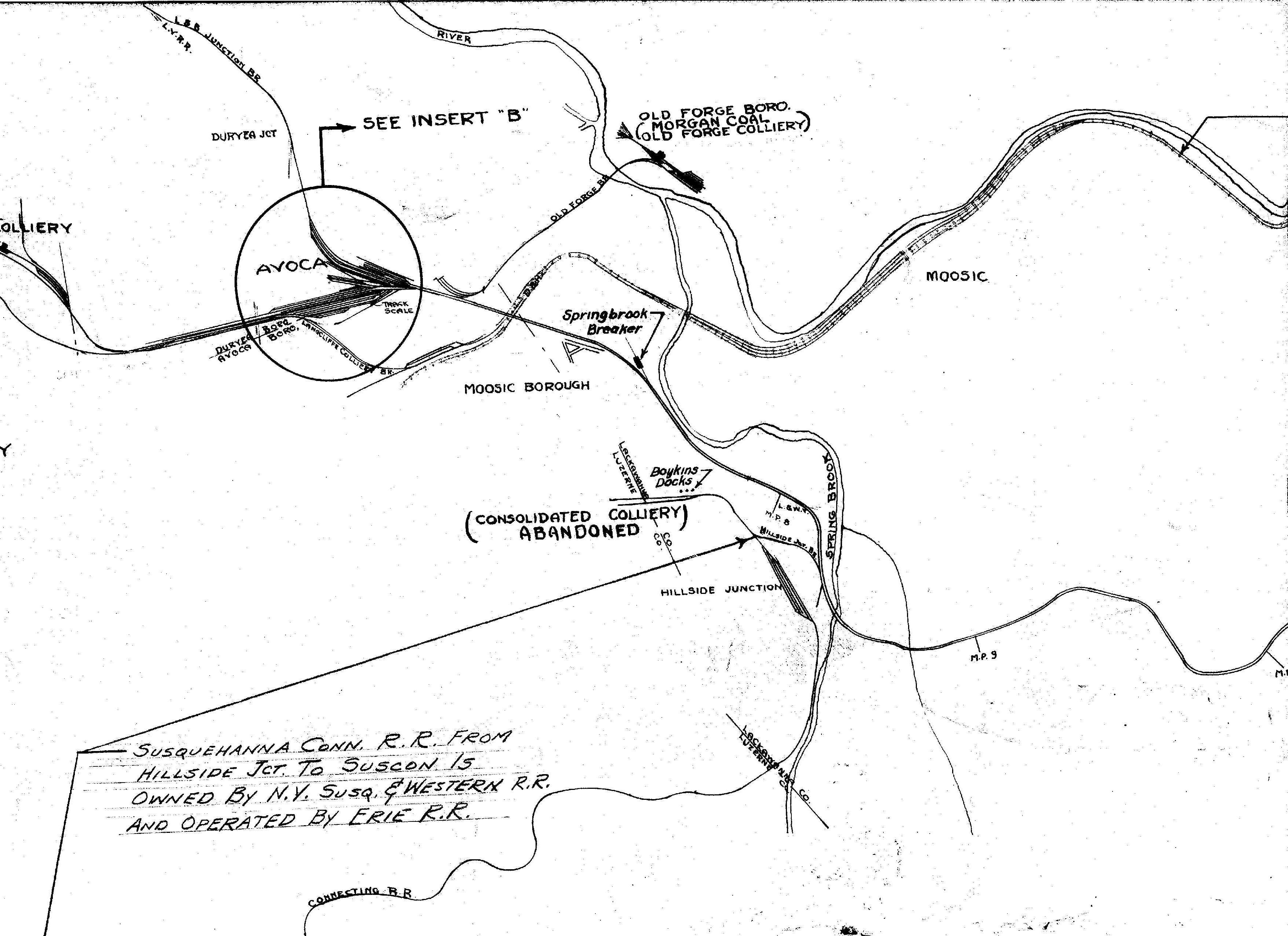
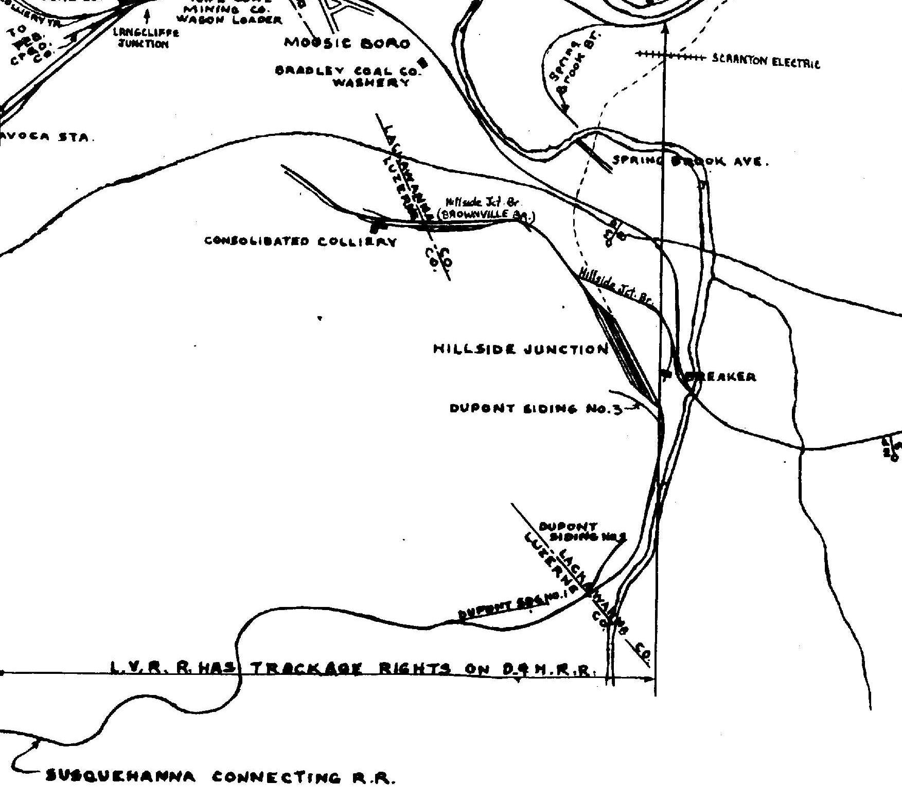
1933-1947 Erie map
1939 Shepherd map
Period Photos
Penn Pilot and Aerial Photos
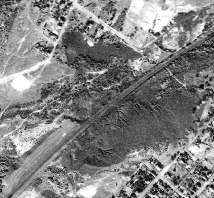
20_67 date 101038 close-up
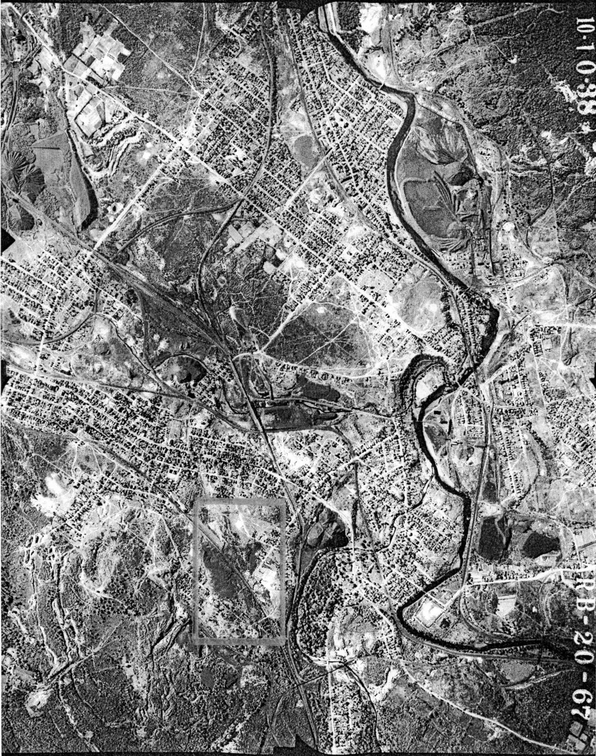
20_67 date 101038
Mine Inspections
Inspector Narratives
City & Sanborn Maps
News, History & Articles
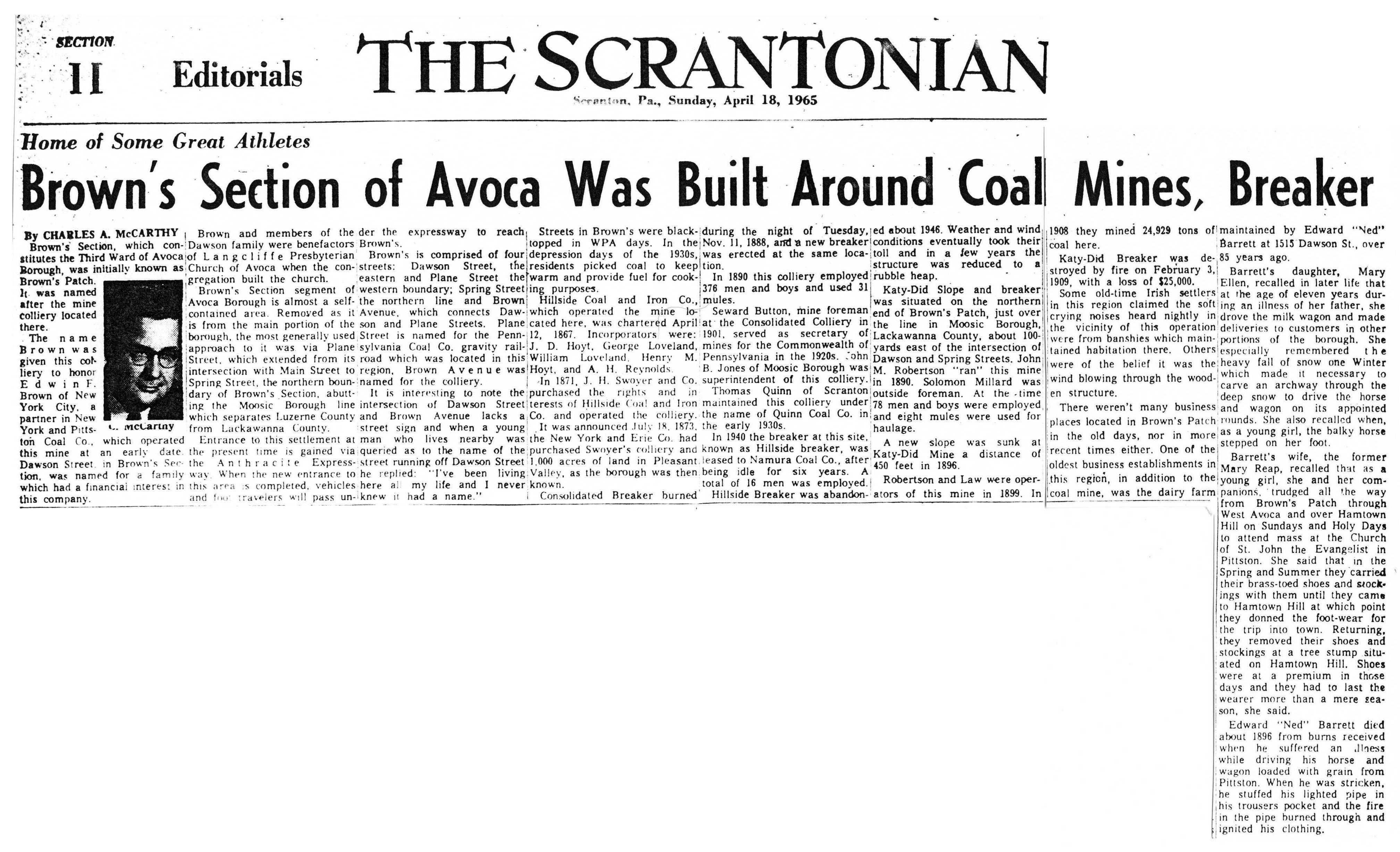
1965-04-18 The Scrantonian
Modern Photos & Google Earth
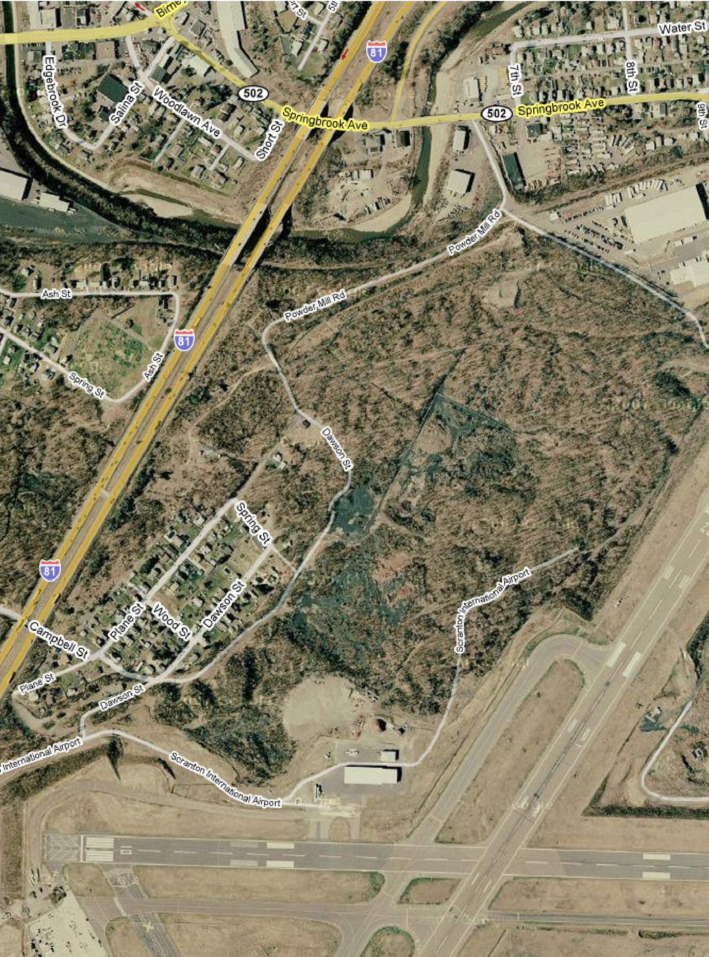
Google Earth
Other Materials
Comments and Feedback