Back
Central (Penna Coal Co)
Area & Railroad Maps
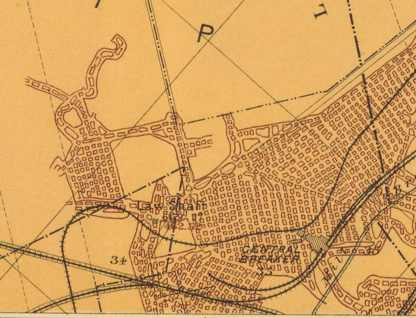
1887 2nd Pa Geo Survey sheet XI
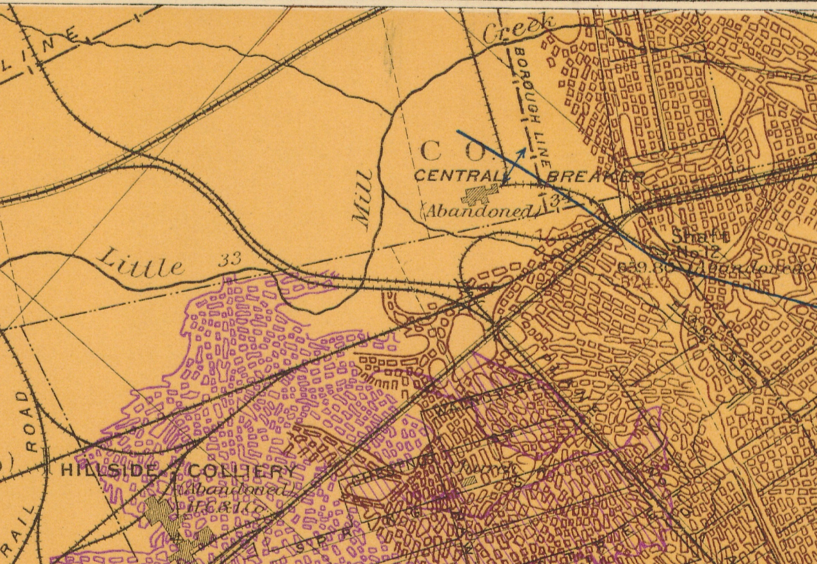
1887 2nd Pa Geo Survey sheet XII
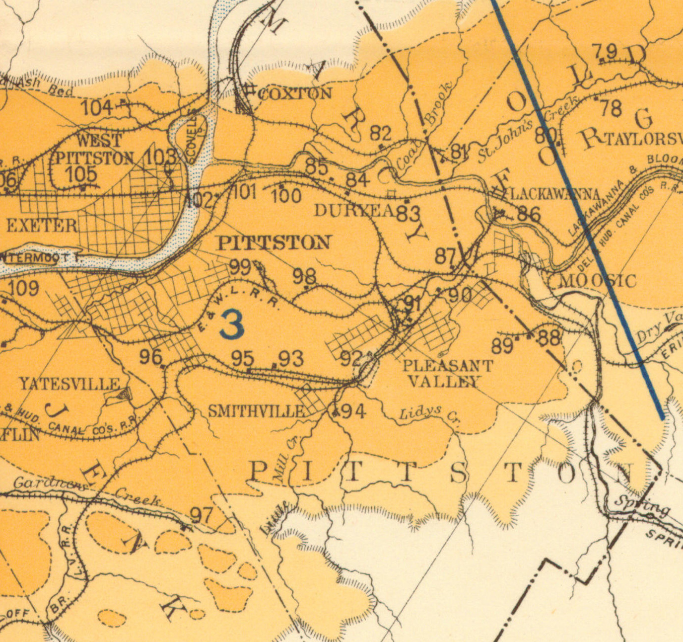
1890 Northern Field (87) PSU
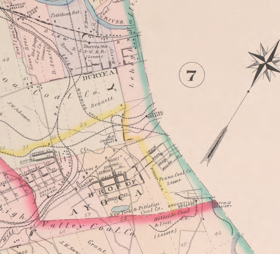
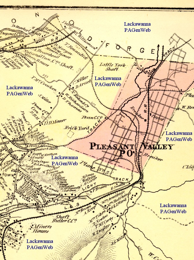
1894 Baist Atlas Wyoming and Lackawanna Valley Plate 5
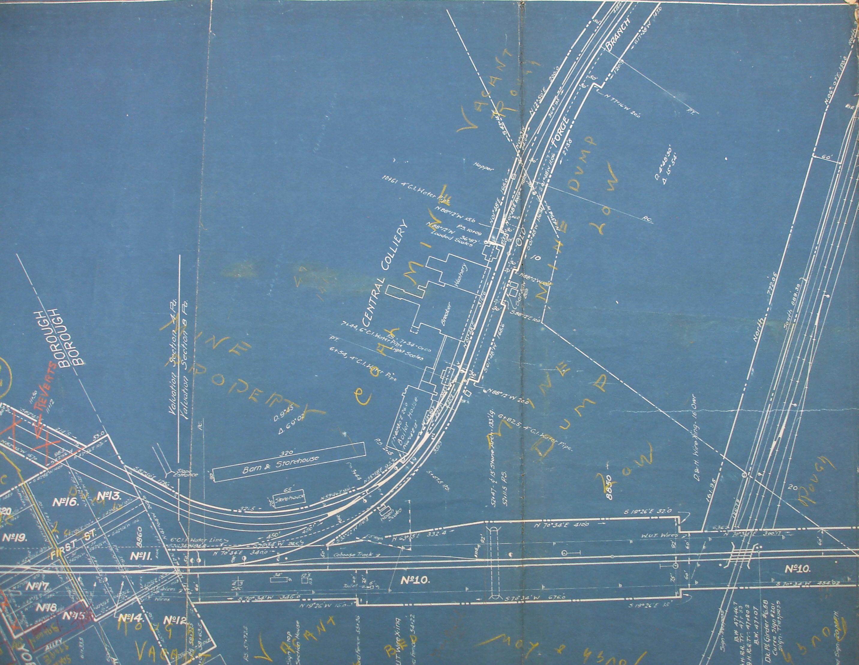
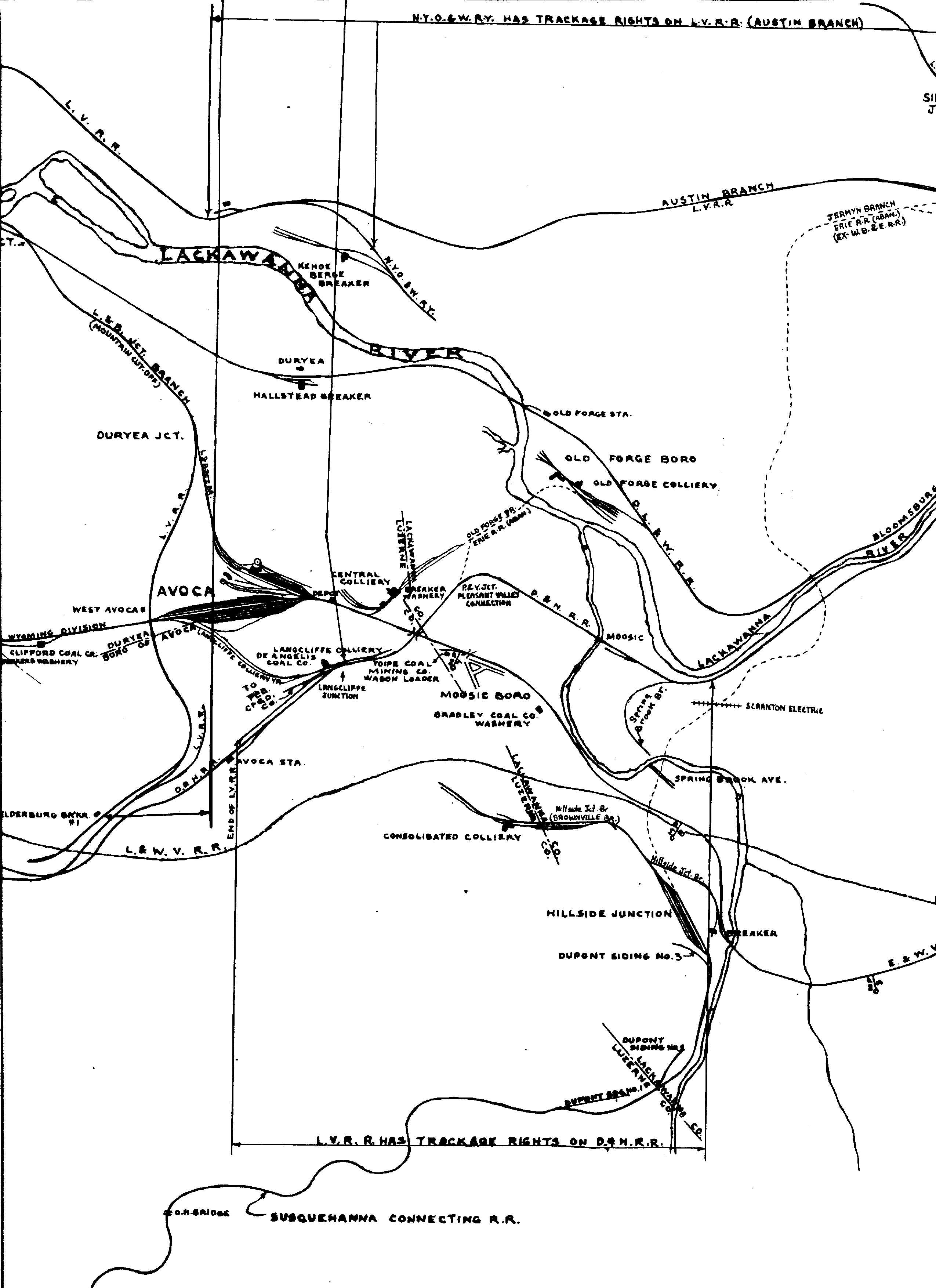
1918 Erie v4 Pa m59
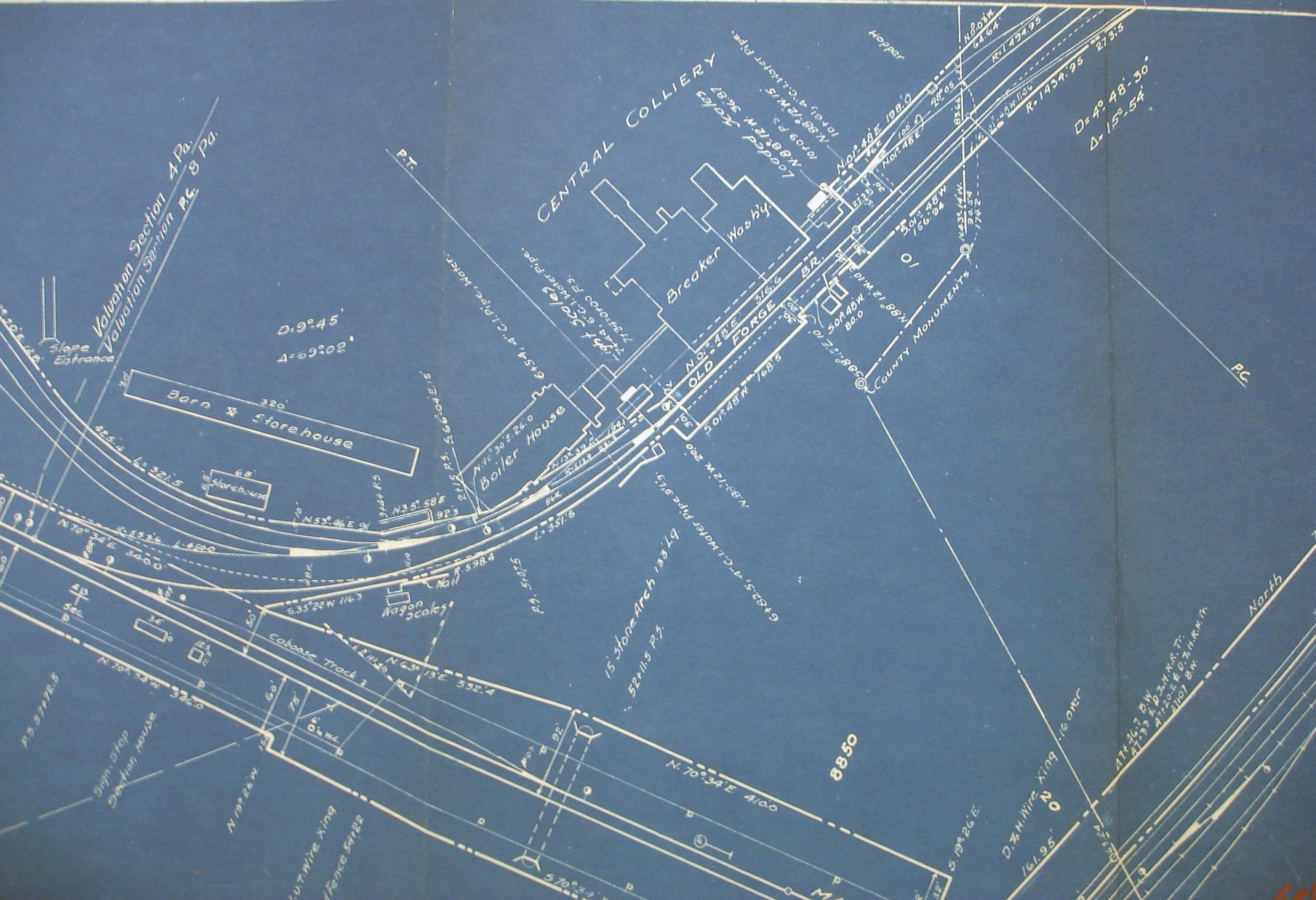
1918 Erie v4 Pa m61
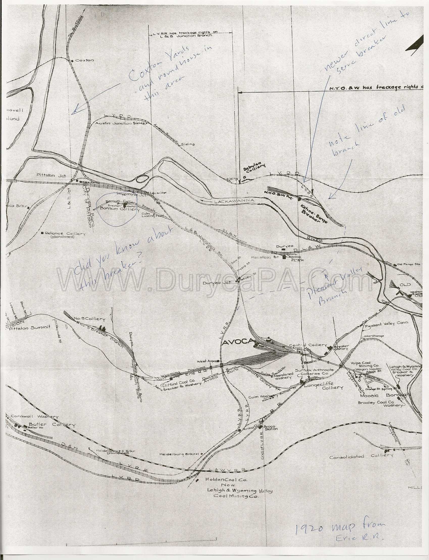
1920 Erie RR map
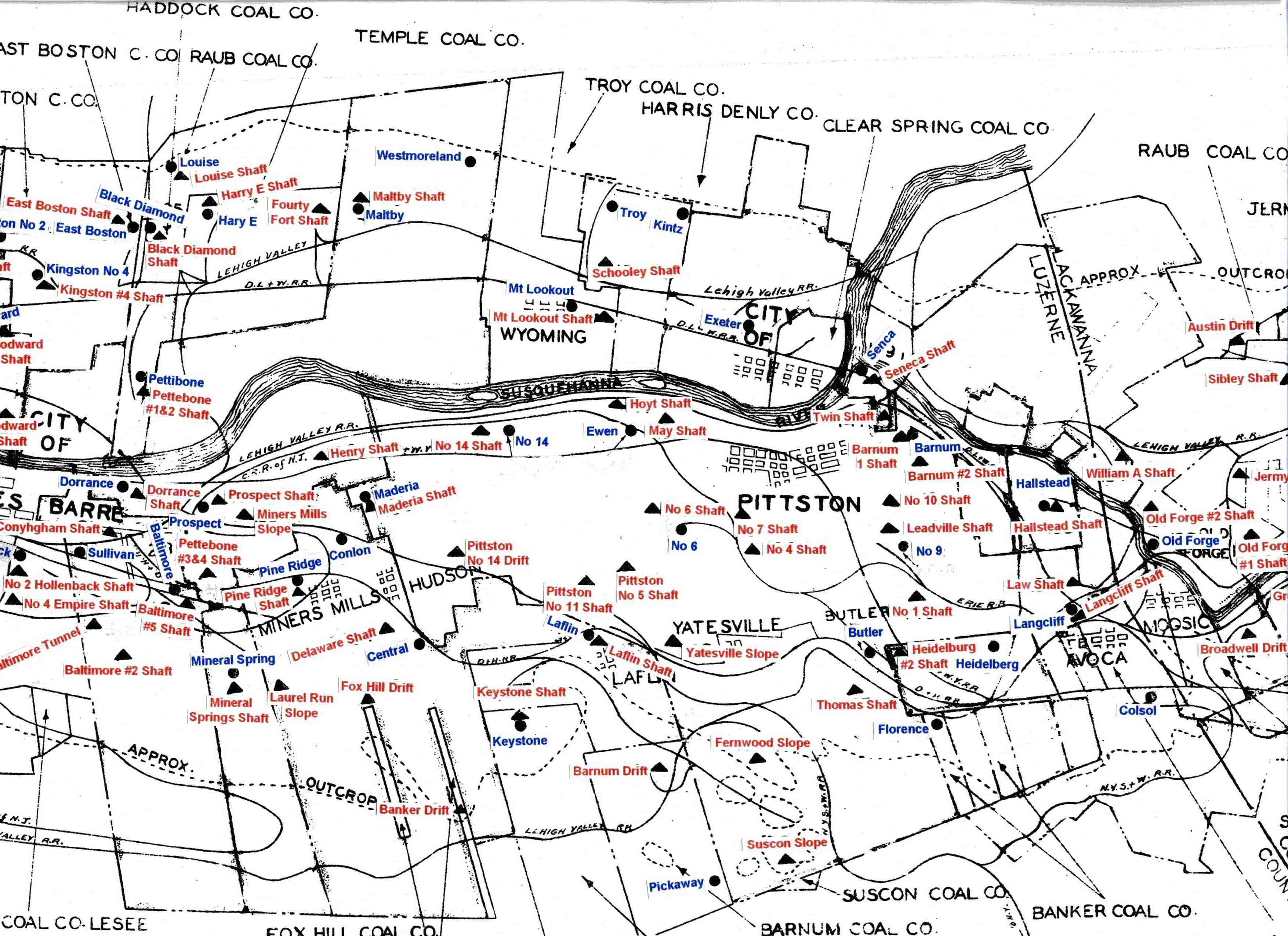
1930 Pittston Co Map Part 2
1939 Shepherd Map
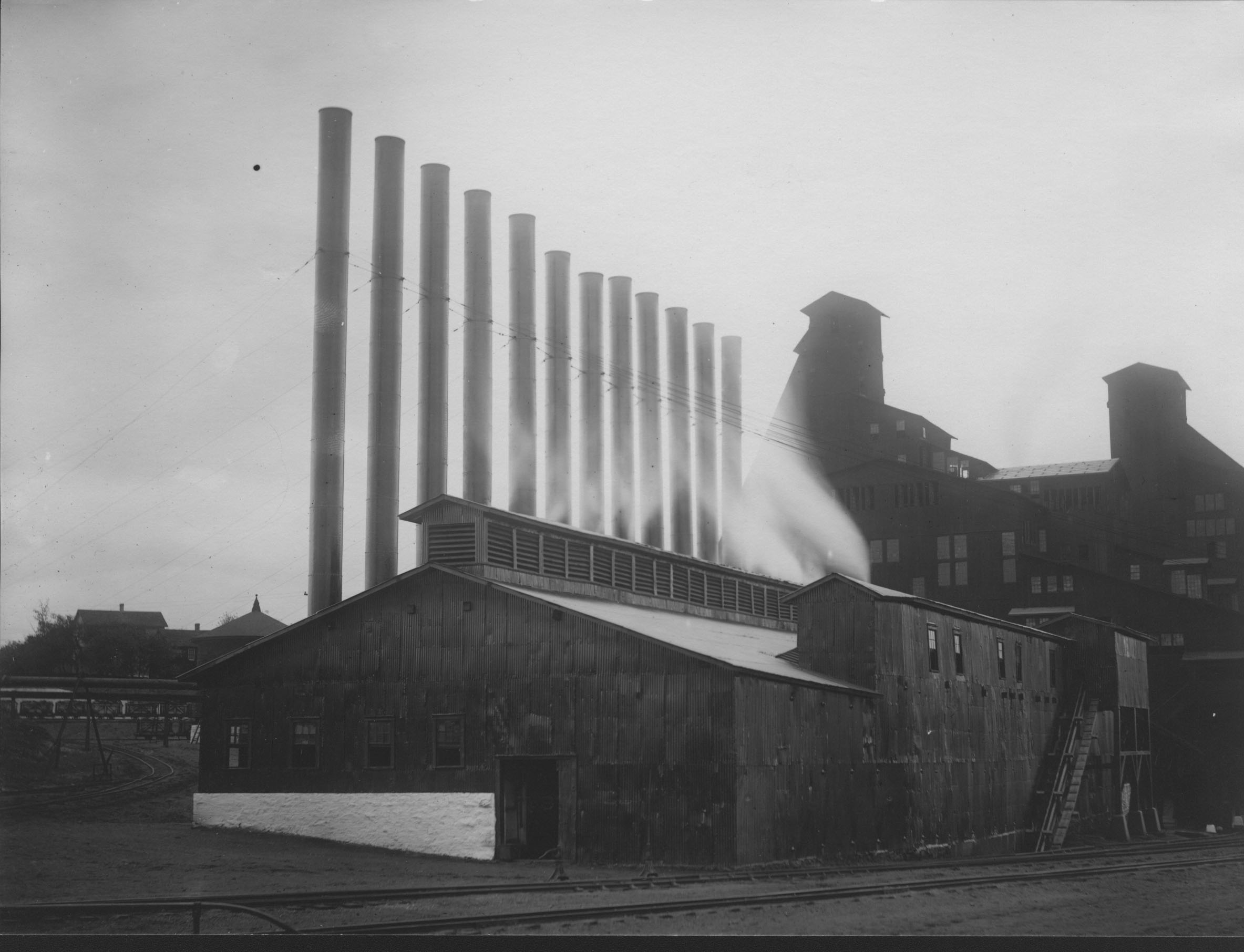
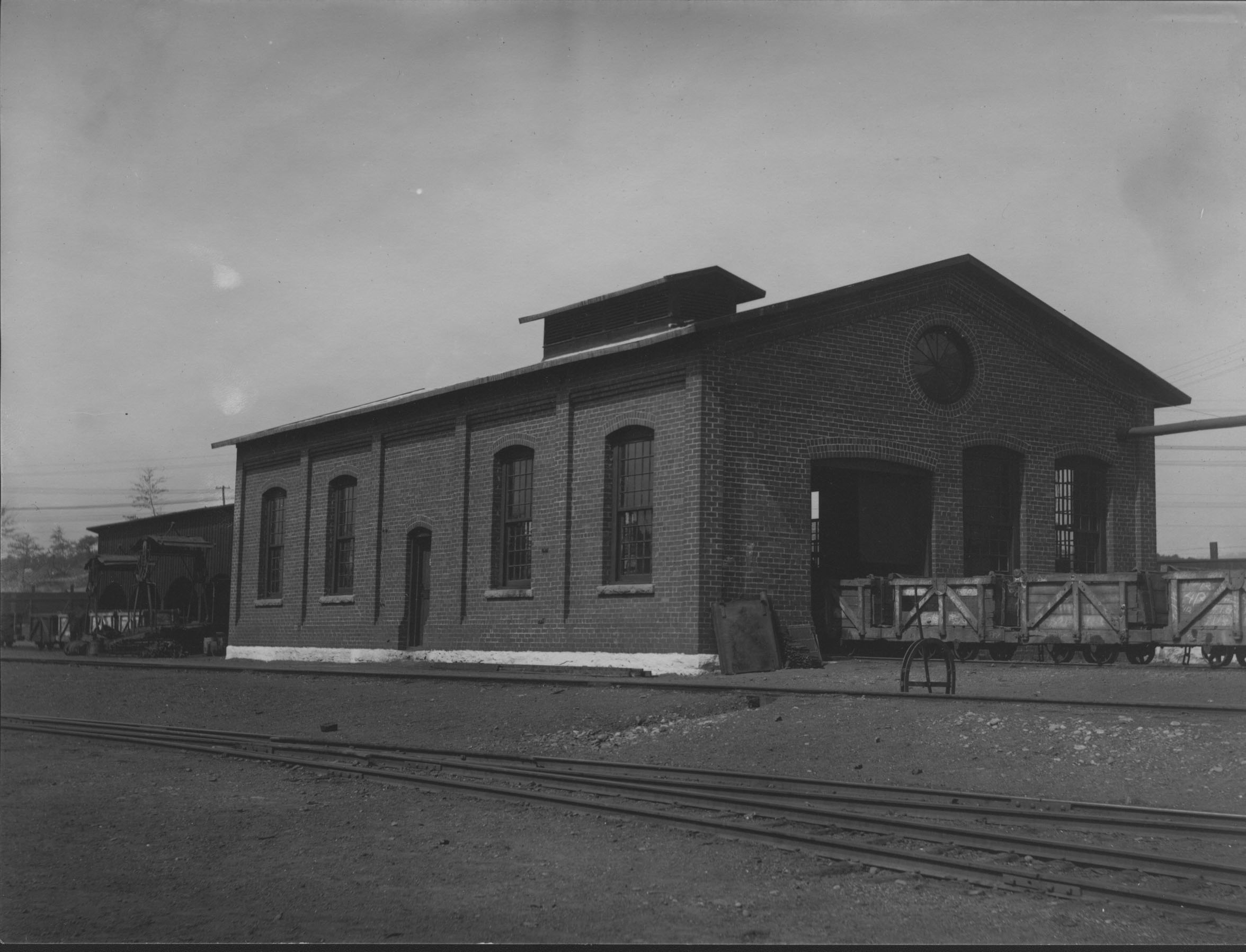
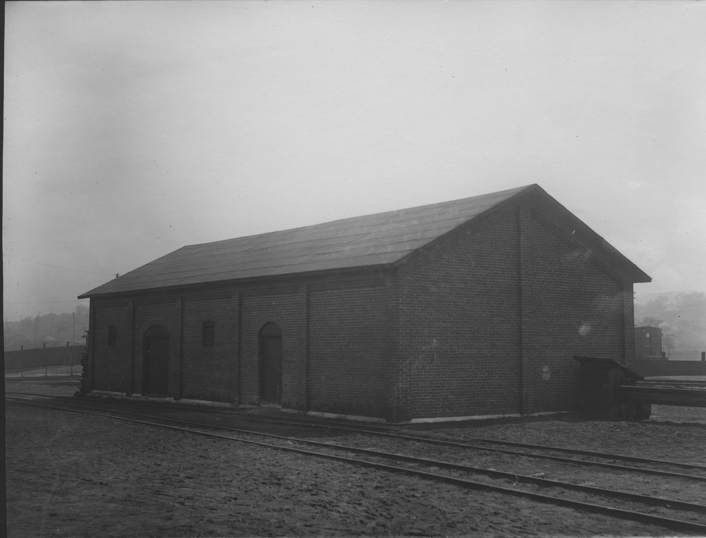
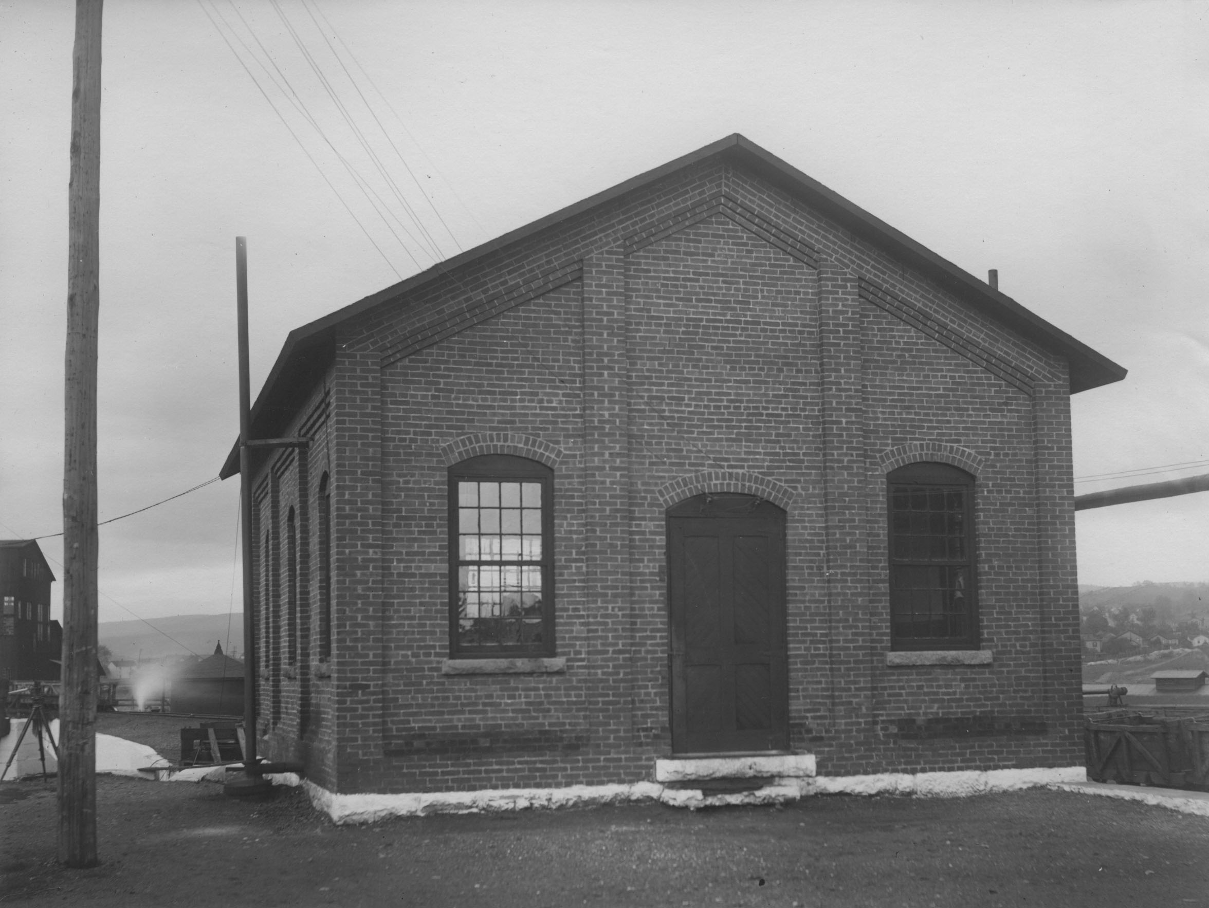
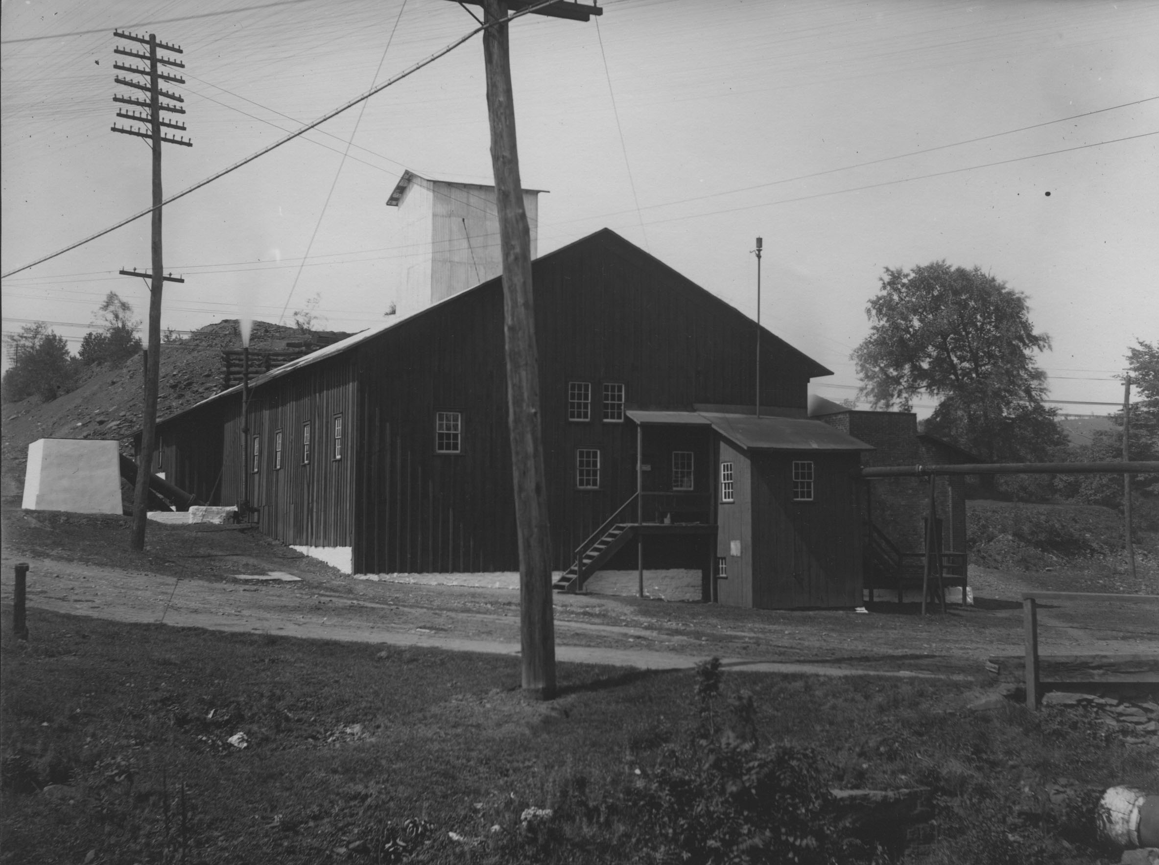
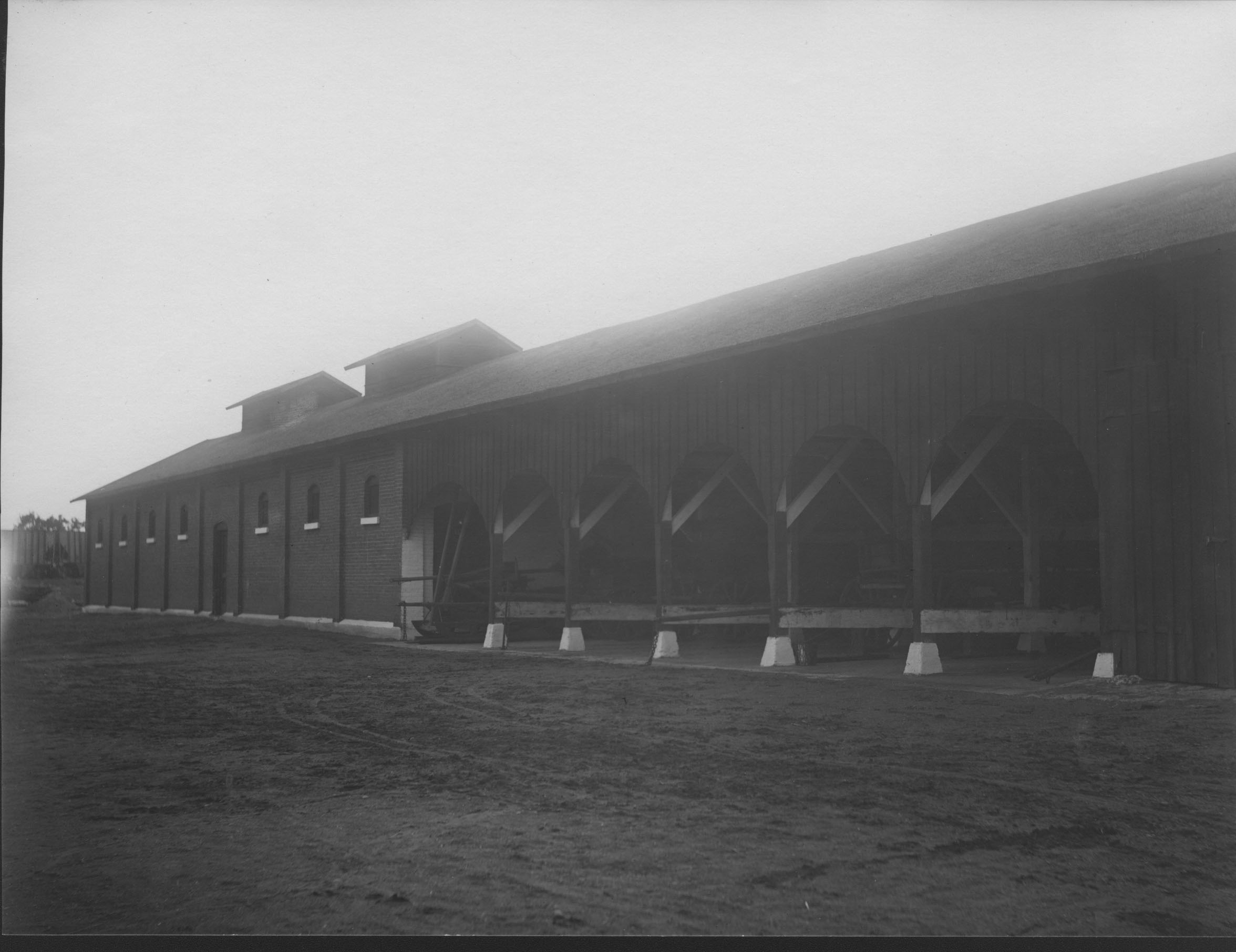
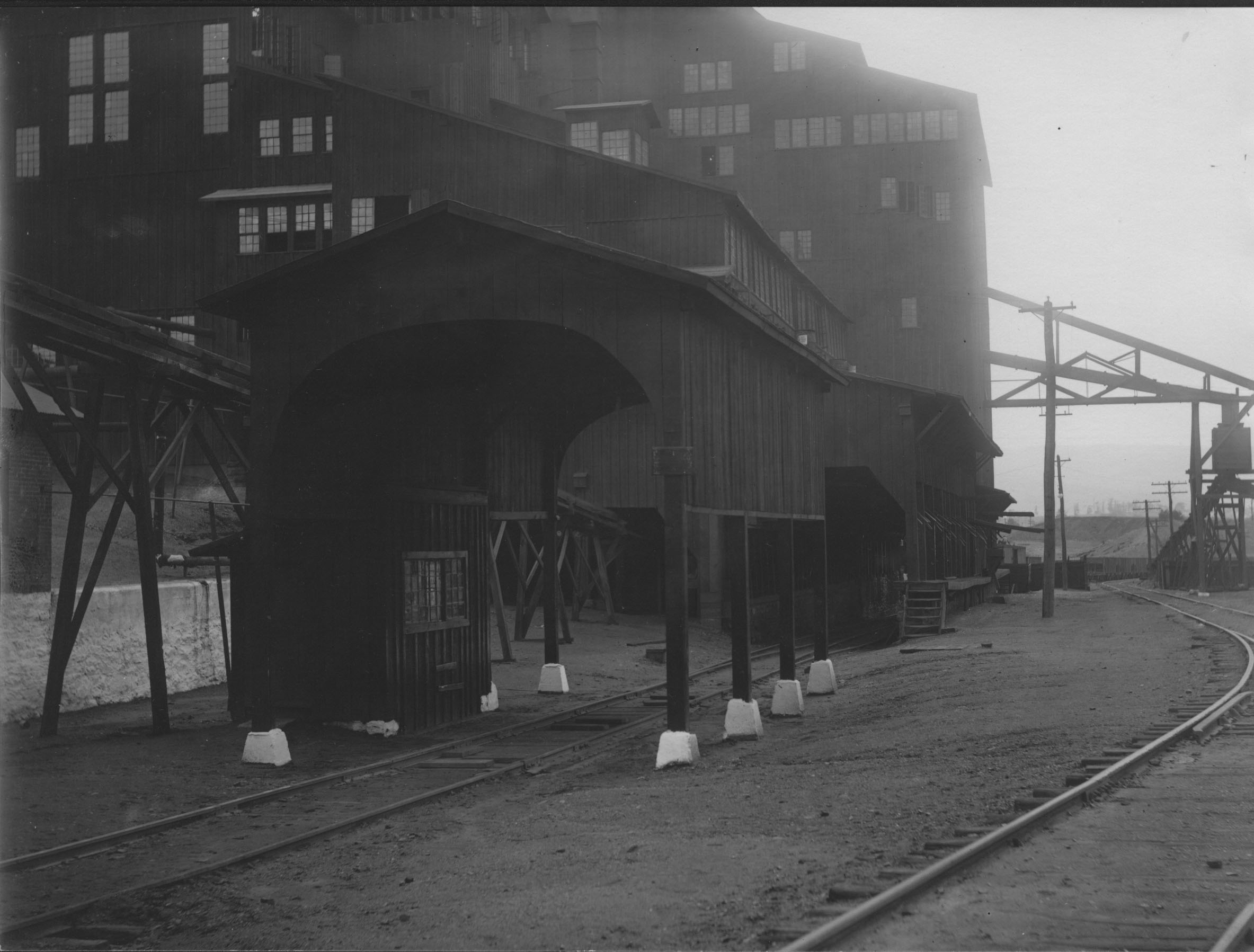
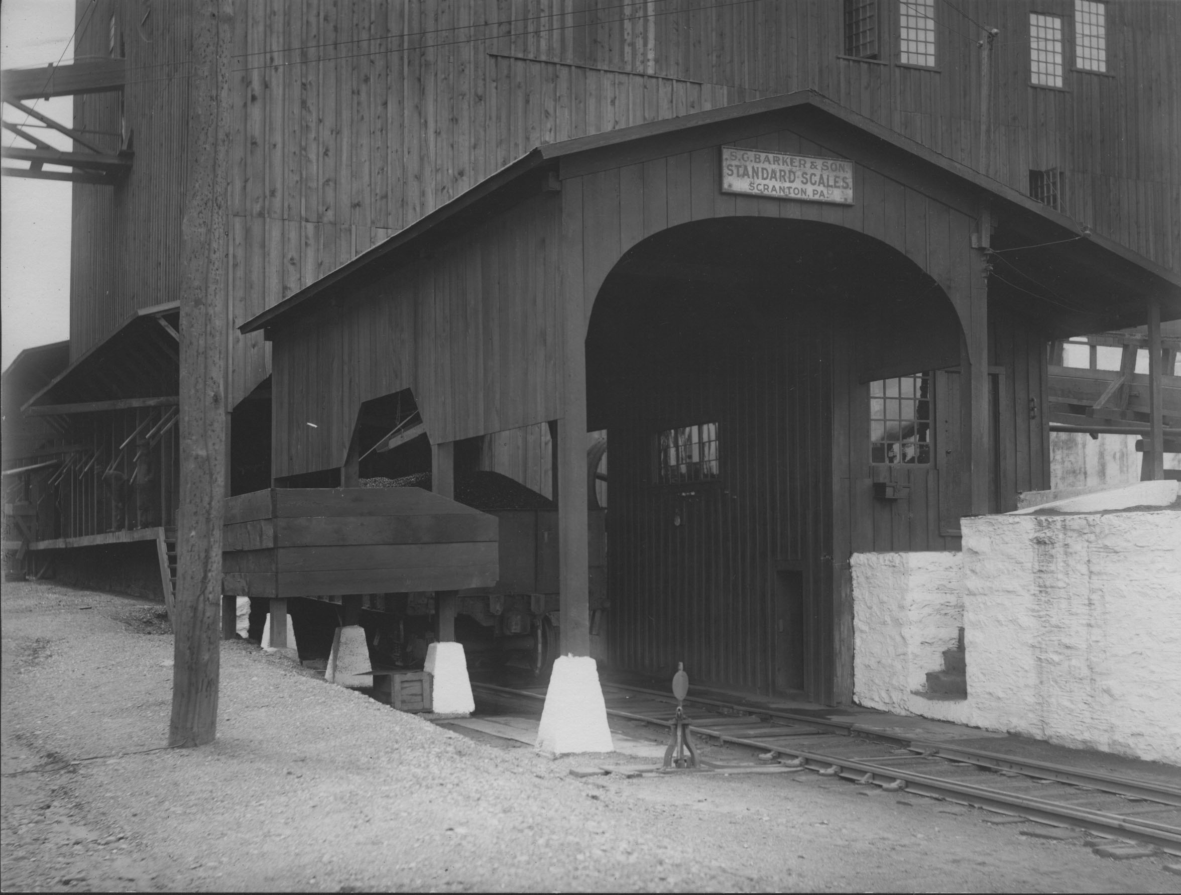
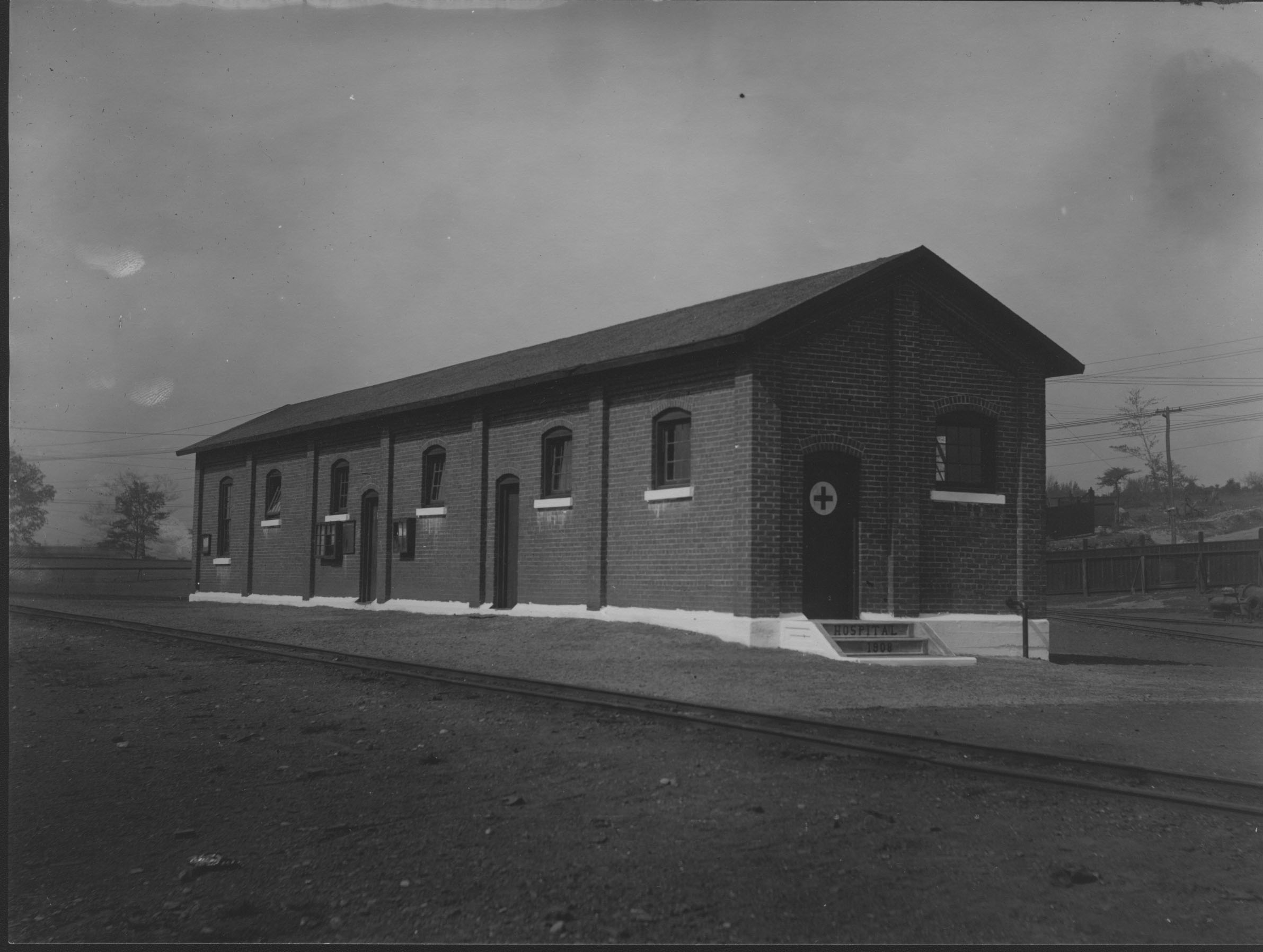
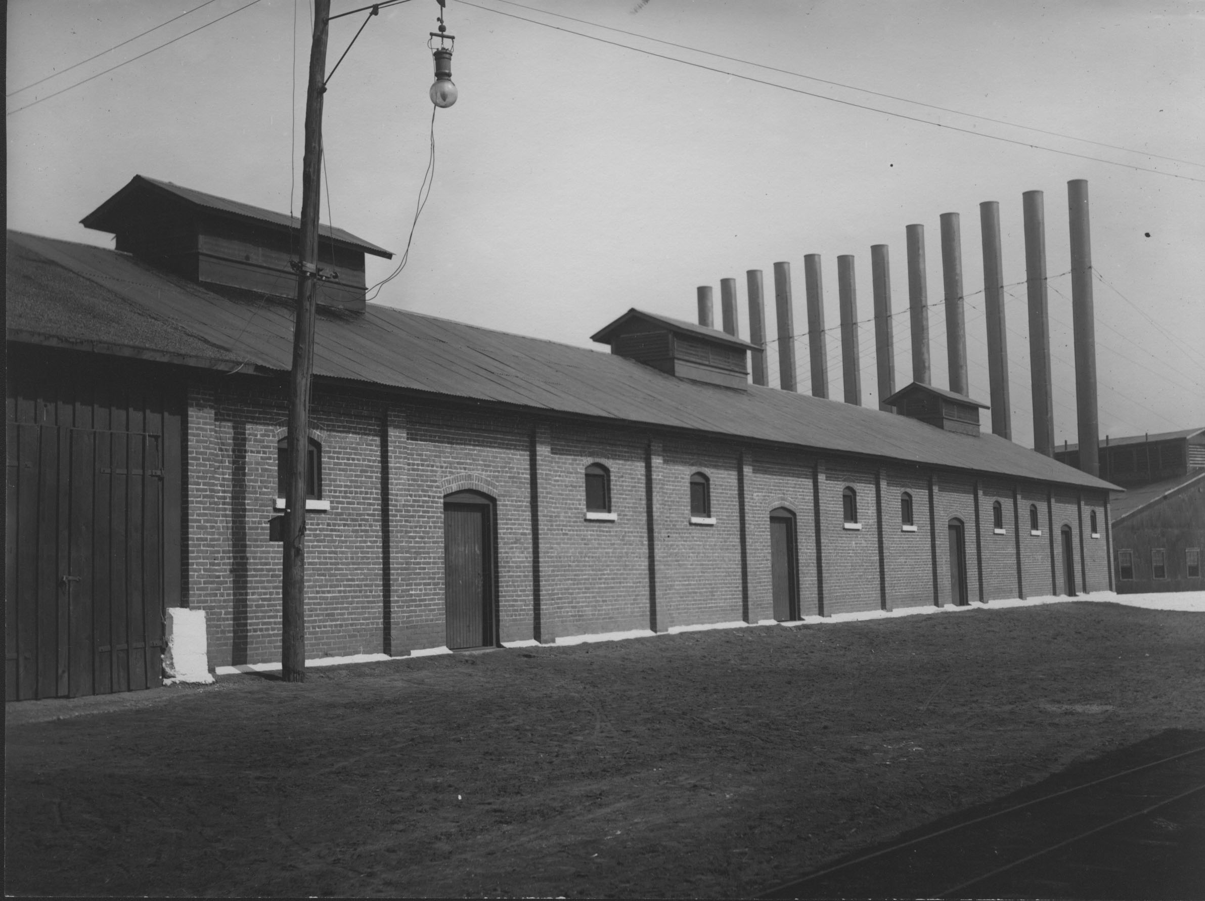
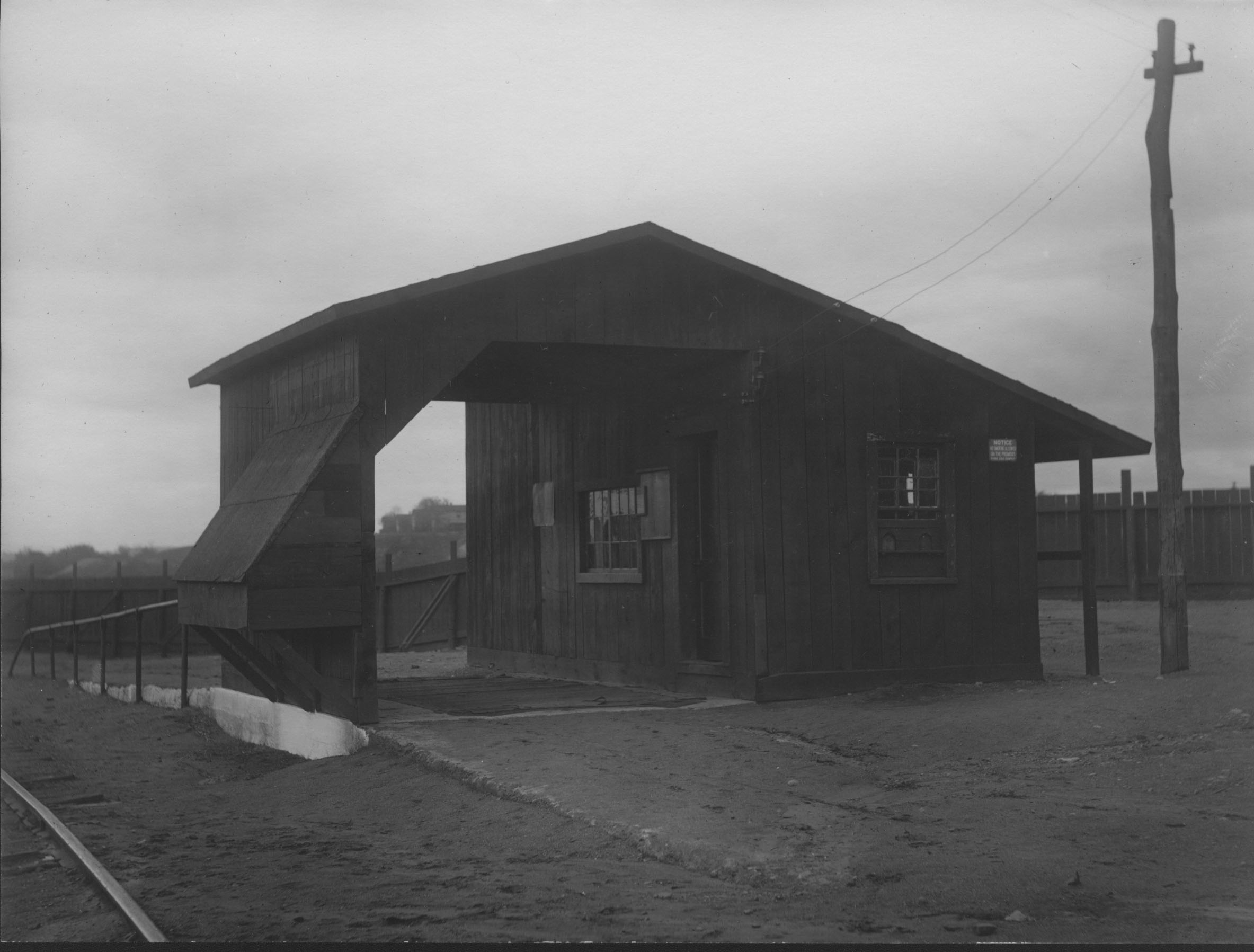
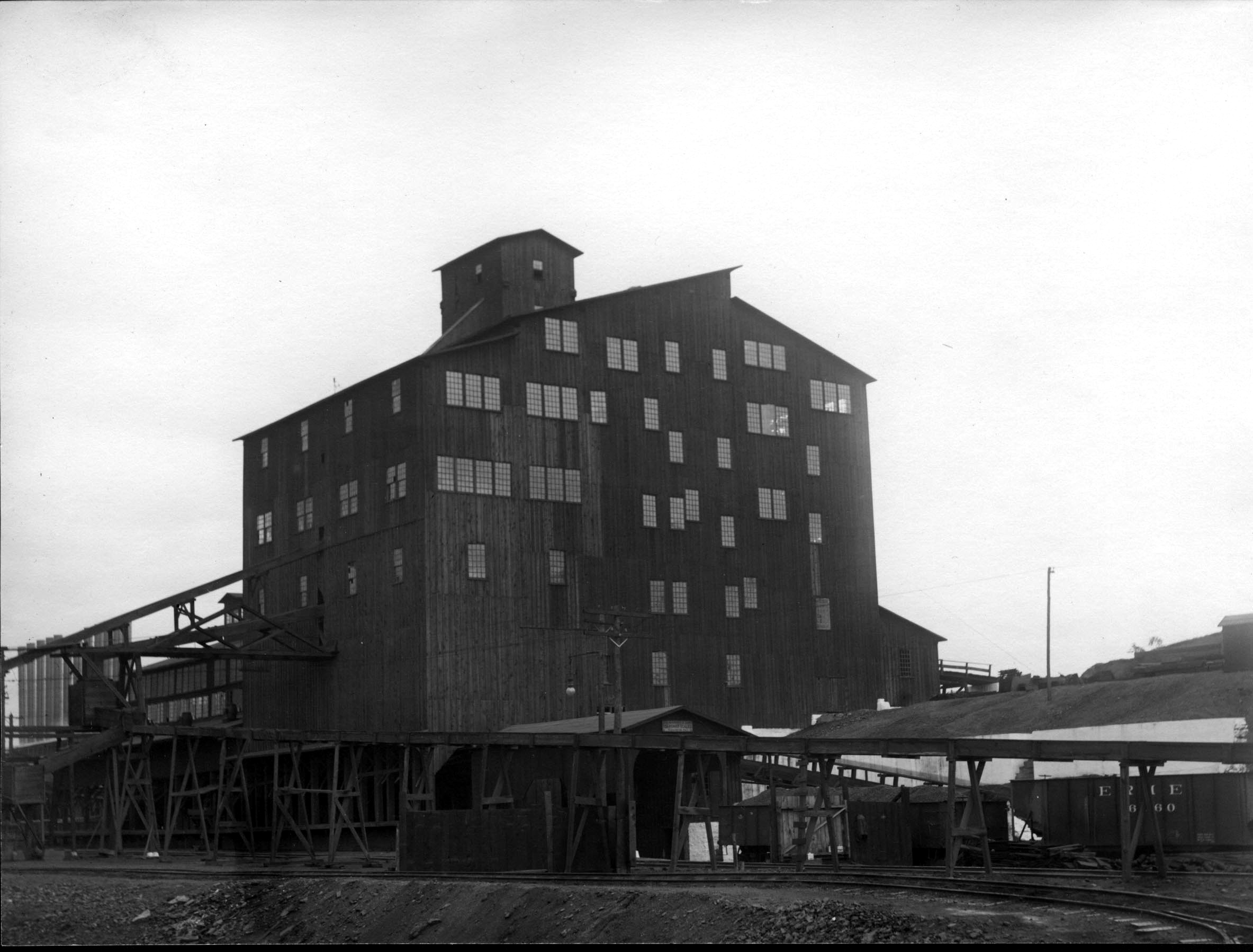
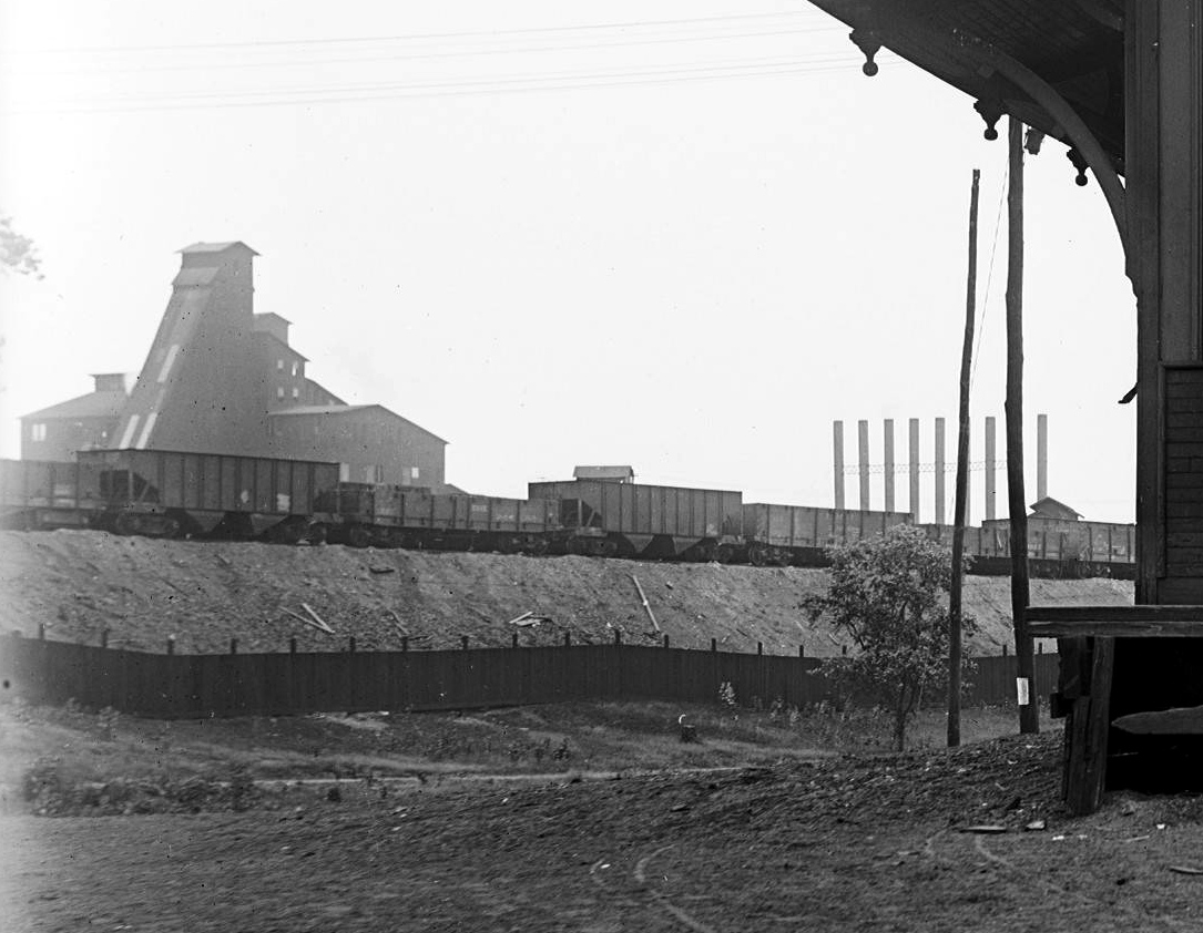
Period Photos
14 photos
14 photos
14 photos
14 photos
14 photos
14 photos
14 photos
14 photos
14 photos
14 photos
14 photos
14 photos
14 photos
14 photos
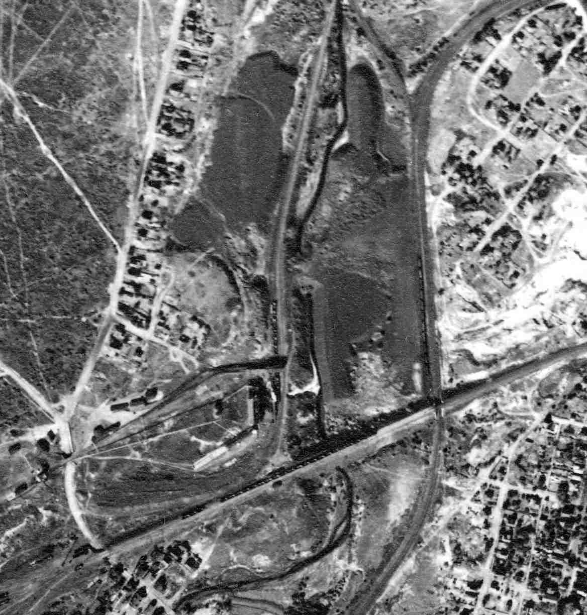
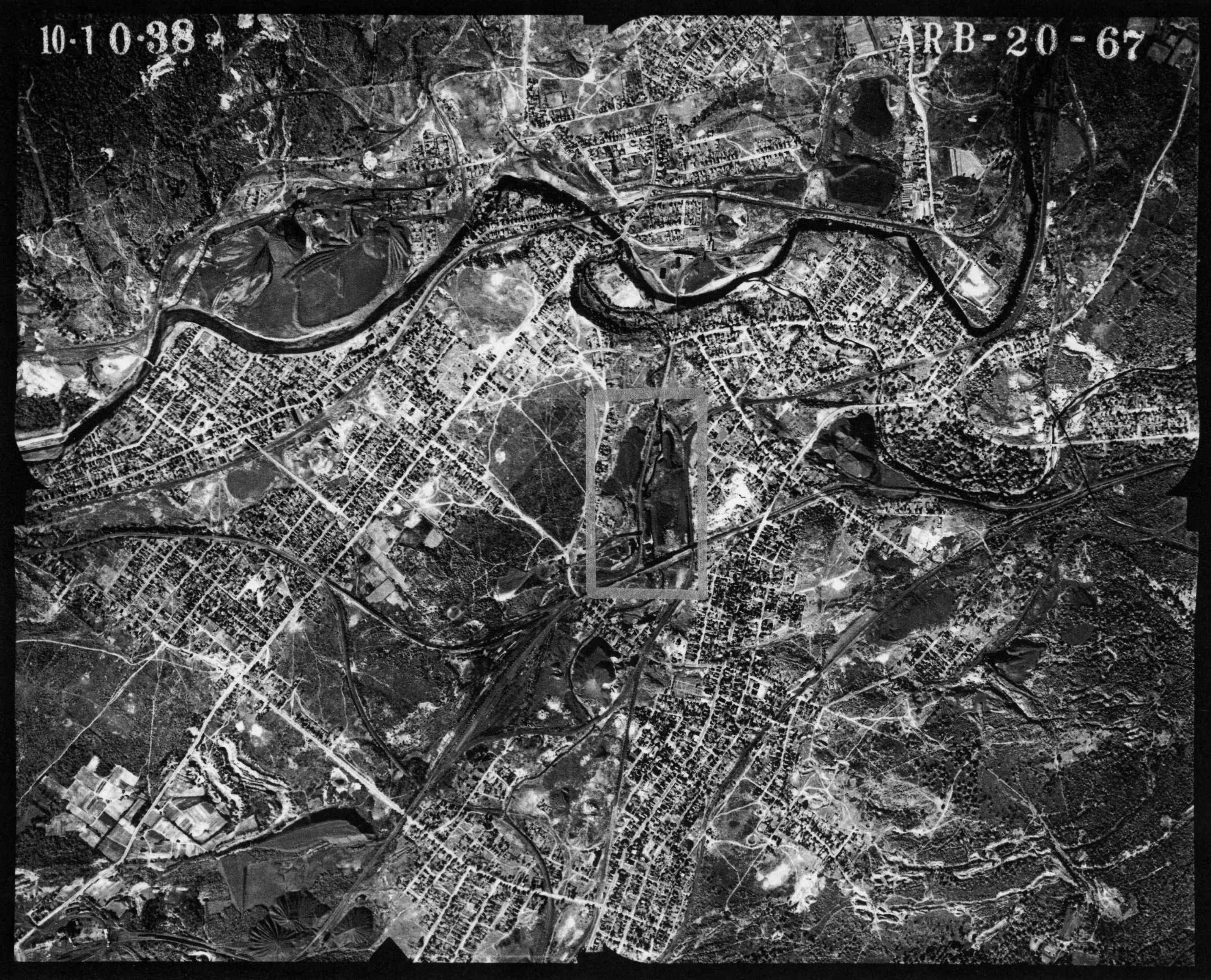
Penn Pilot and Aerial Photos
20_67 date 101038 close-up
20_67 date 101038
Mine Inspections
Inspector Narratives
City & Sanborn Maps
1873 Pittston Township
Duryea 1926 Sheet 18
Duryea 1947 Sheet 18
News, History & Articles
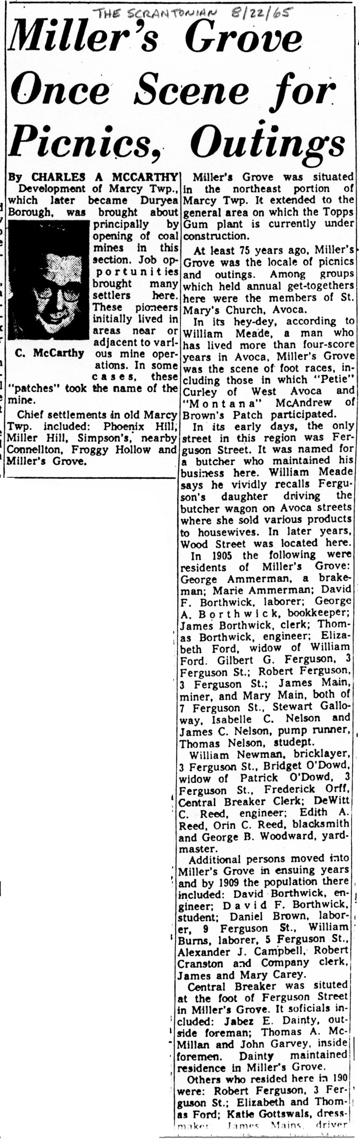
1965-08-22a The Scrantonian
1965-08-22b The Scrantonian
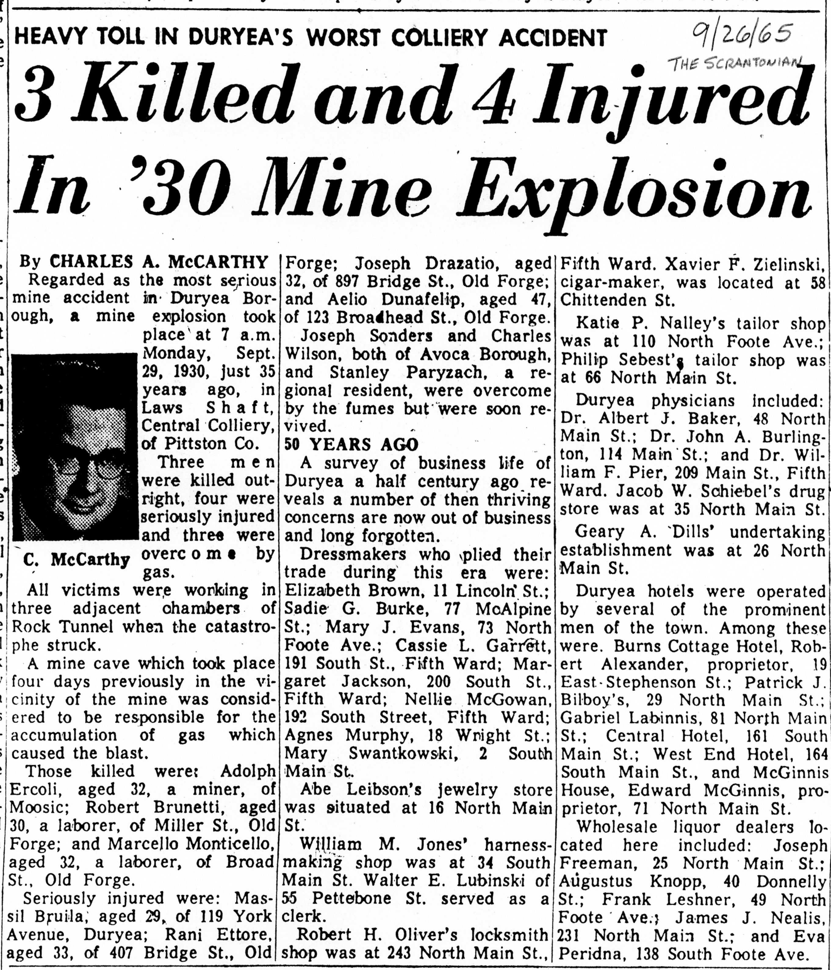
1965-09-26 The Scrantonian
Modern Photos & Google Earth
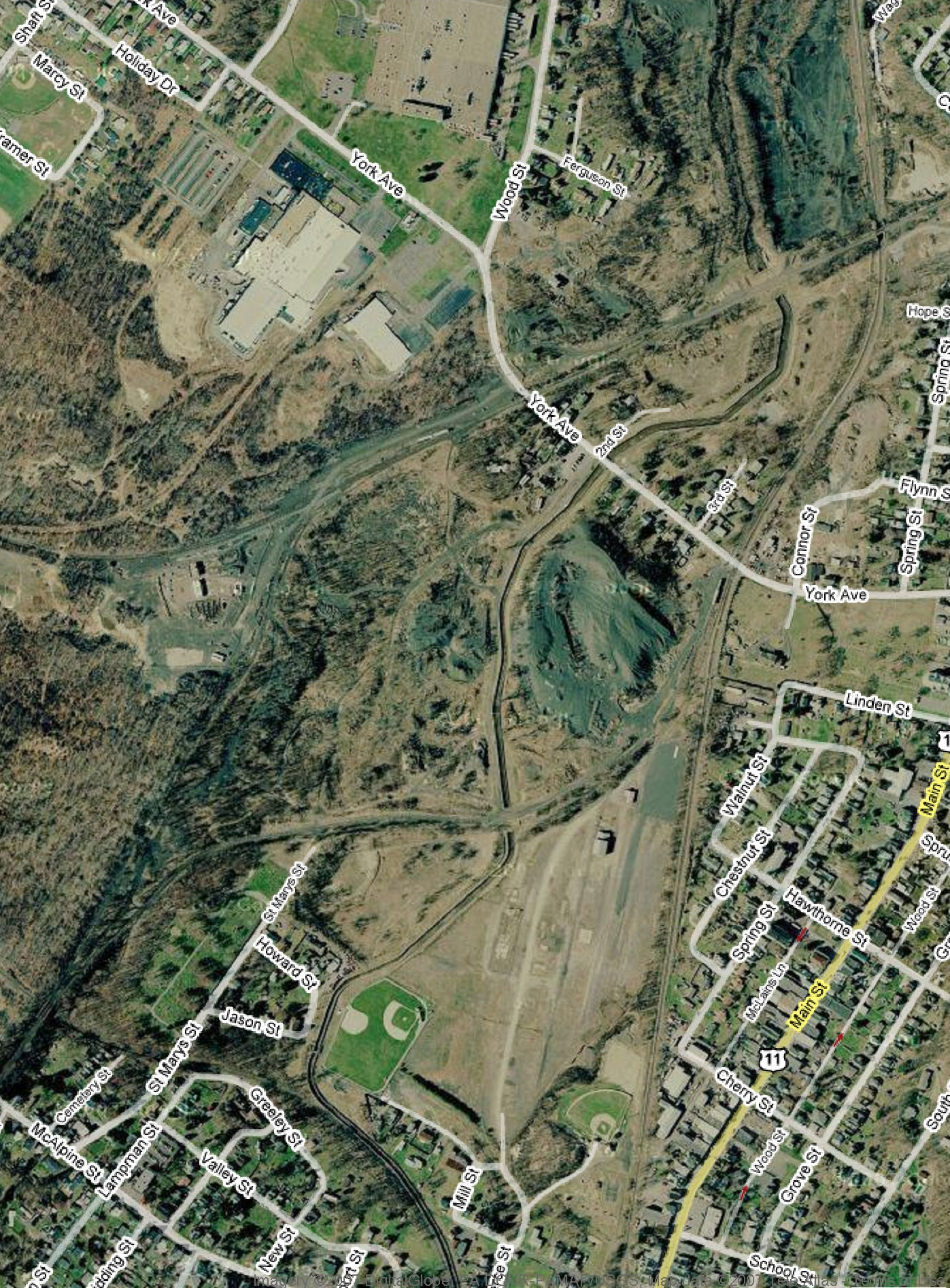
Google Earth
Other Materials
1885 Pennsylvania Coal Co History - Hollister 5th edition
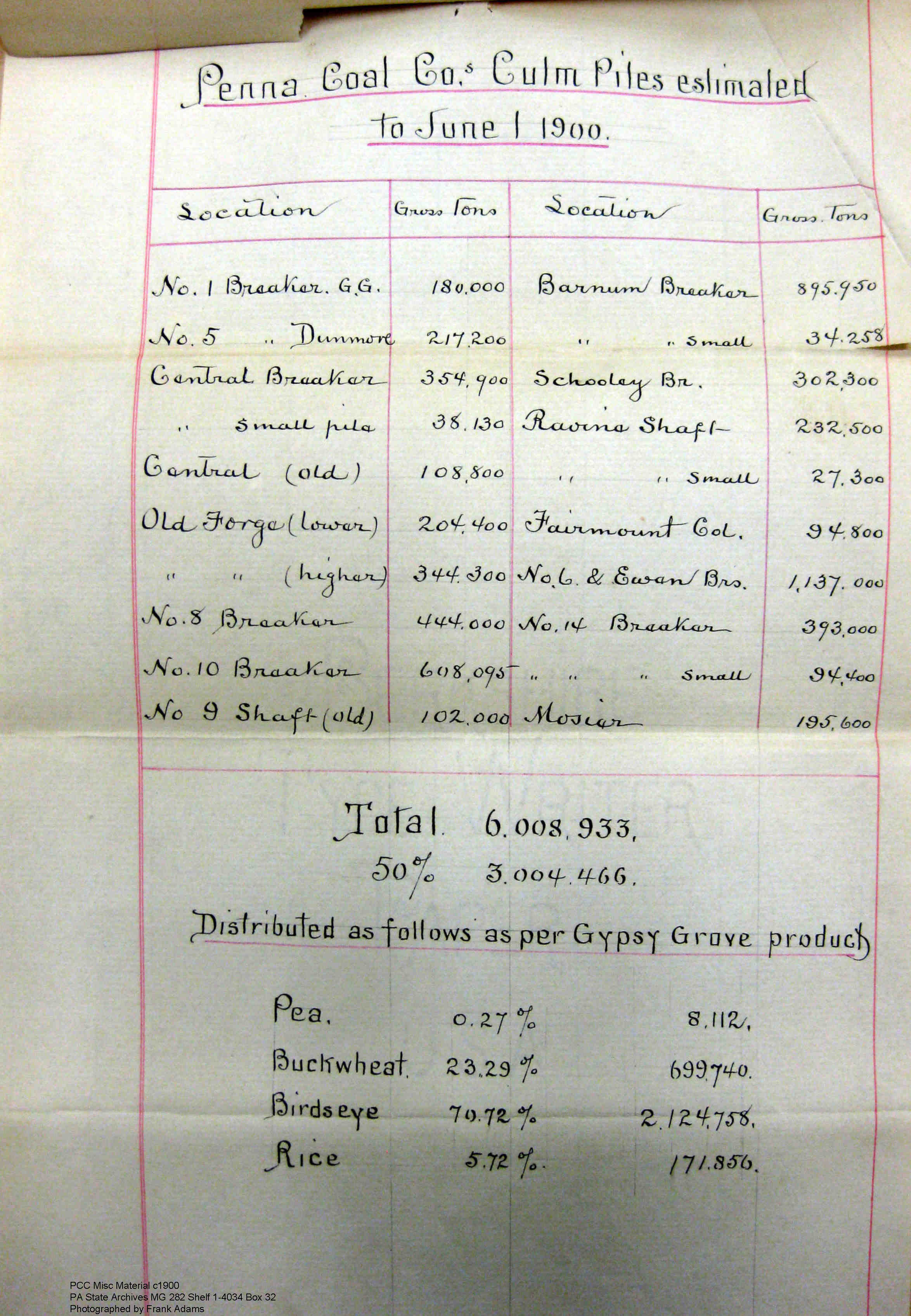
1900 MG 282 Shelf 1-4034 Box 32
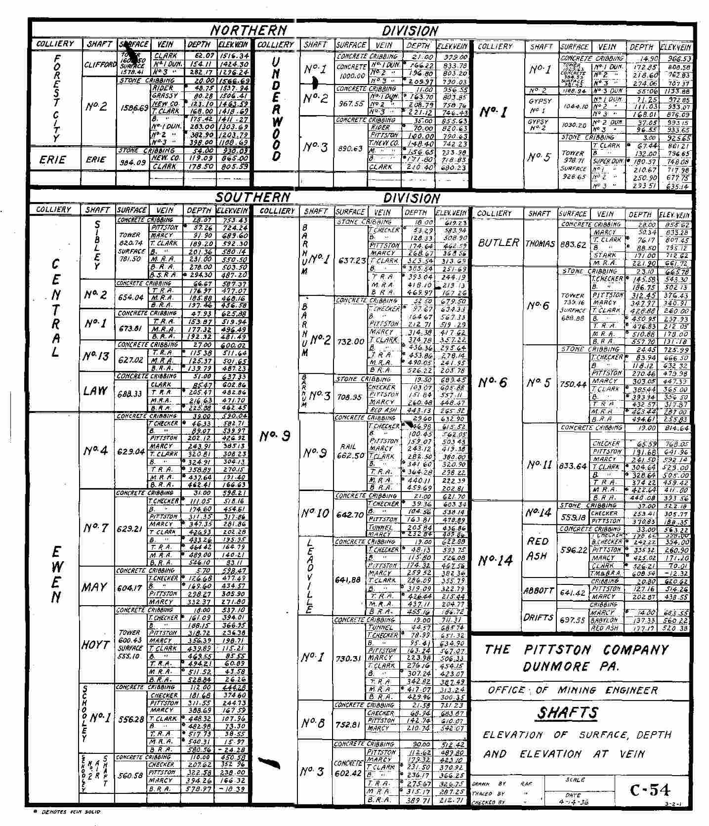
1936 PCC_Veins
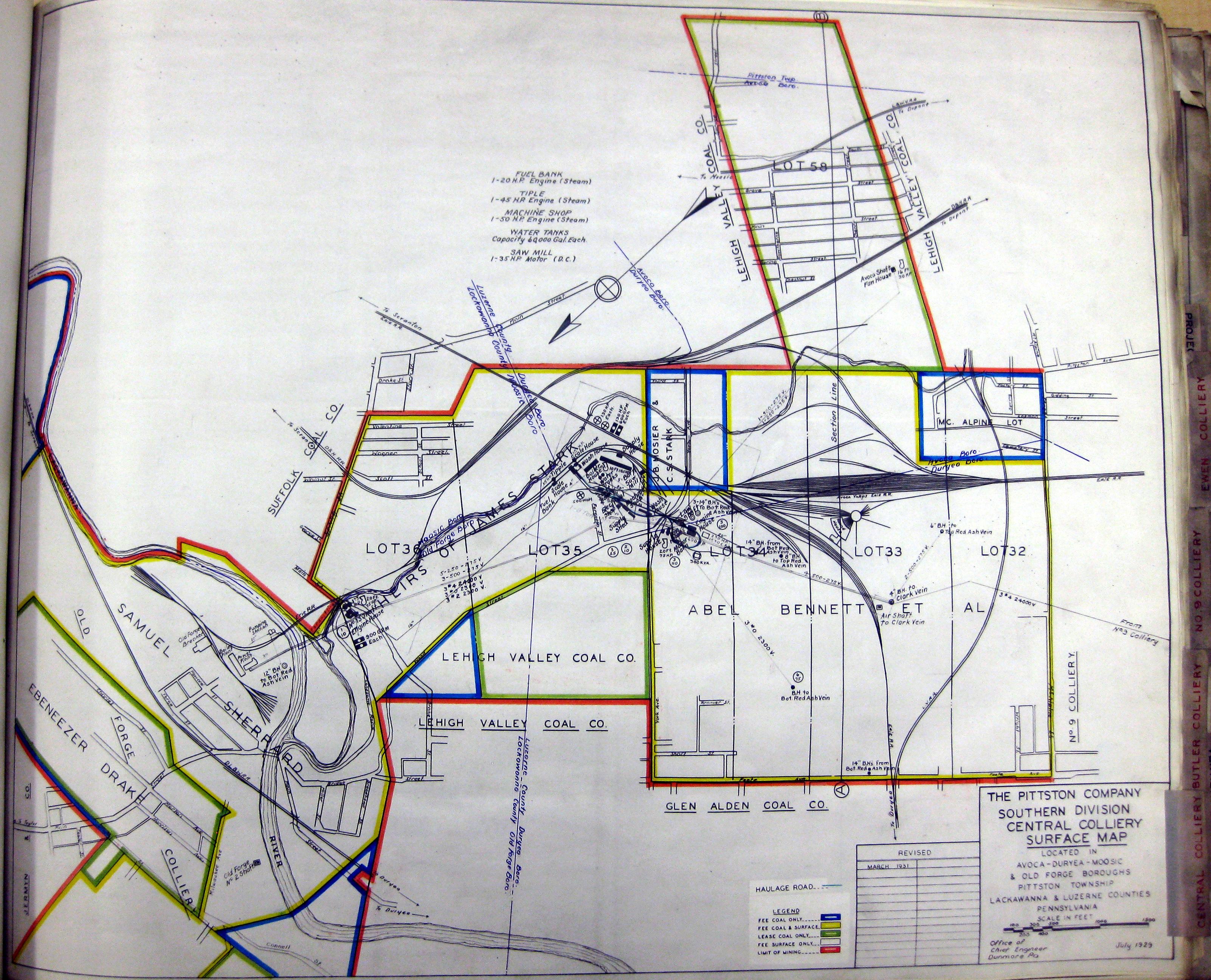
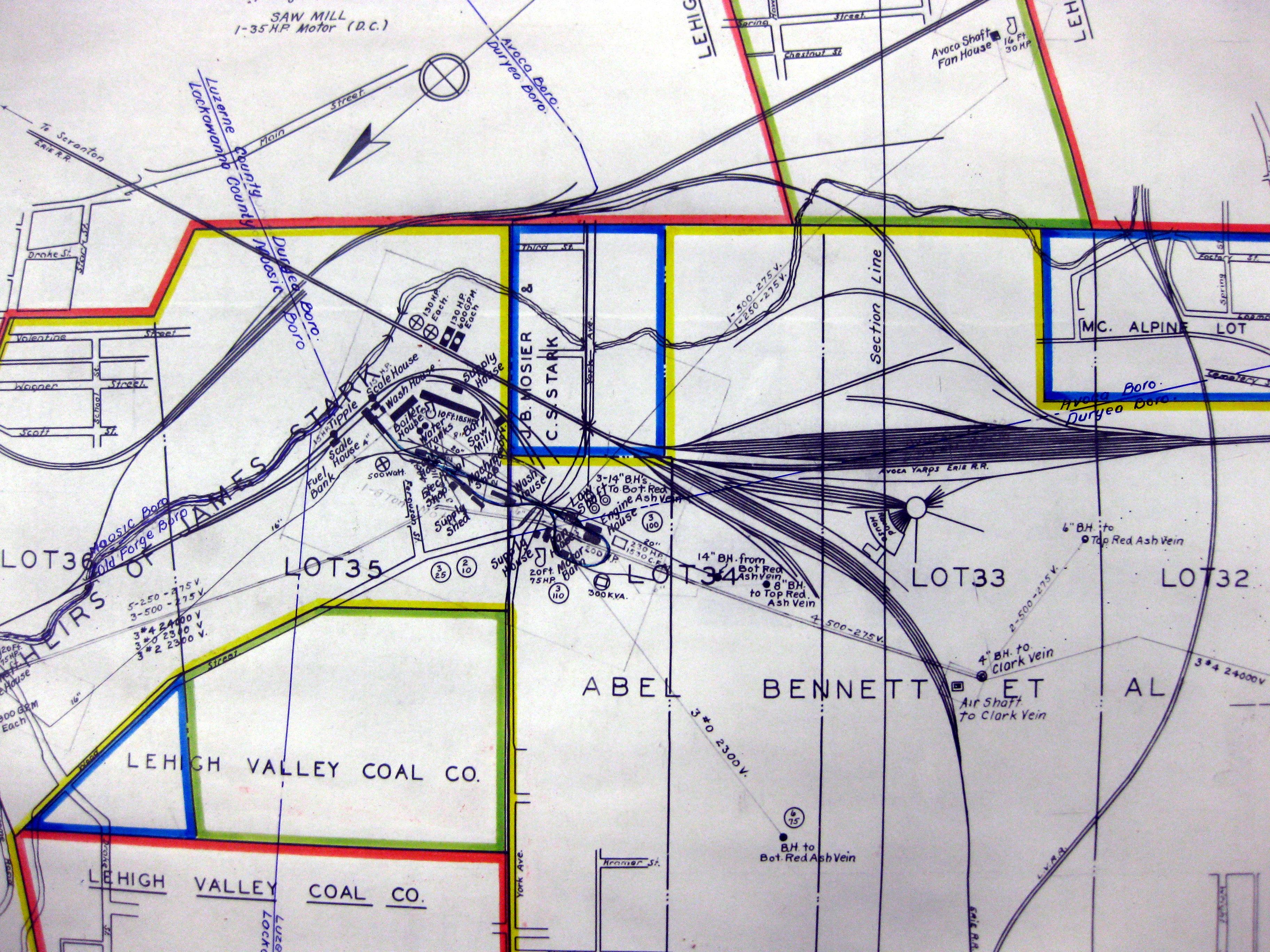
Central Colliery 1 Surface 07-1929
Central Colliery 1a Surface 07-1929
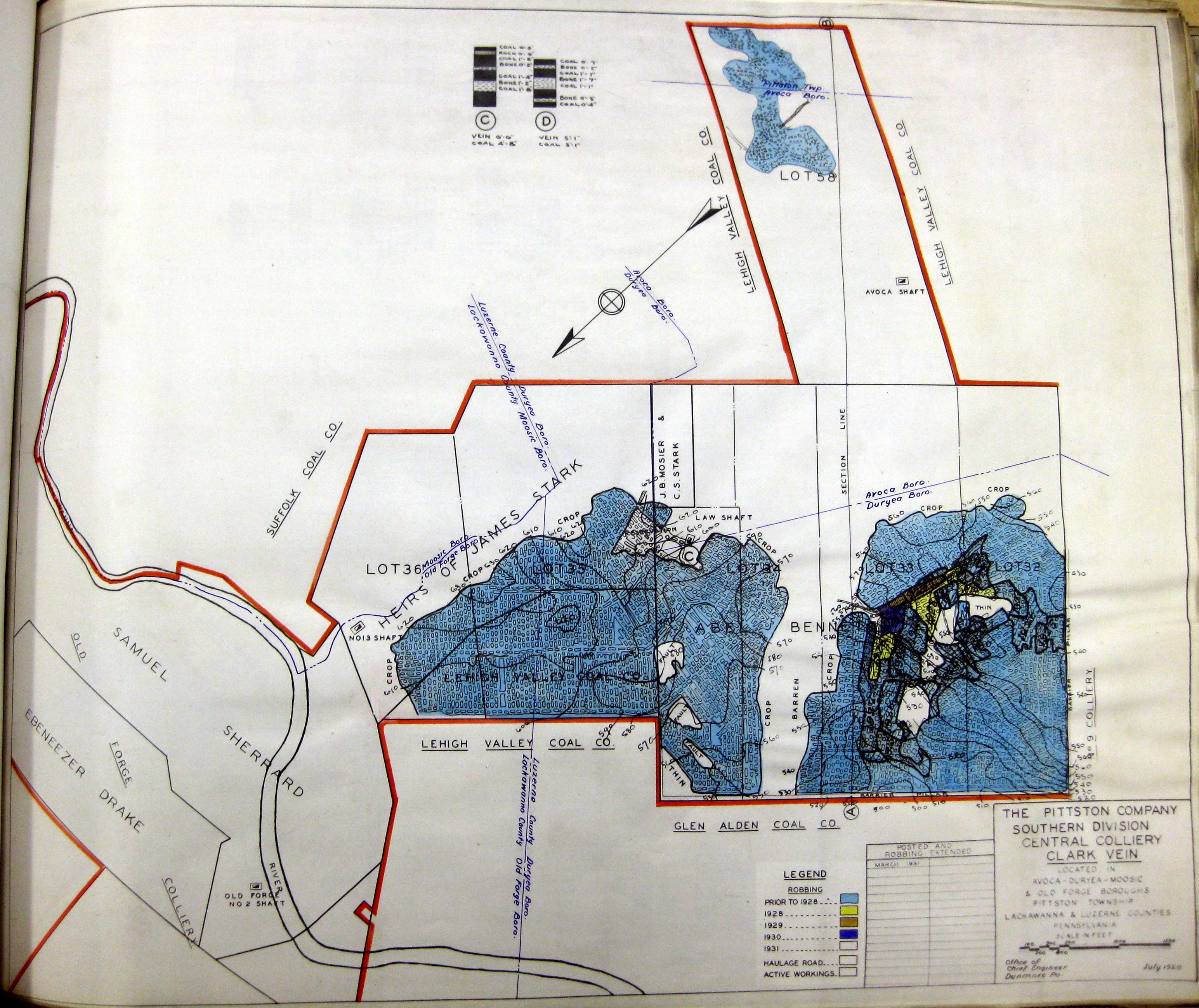
Central Colliery Clark Vein 07-1929
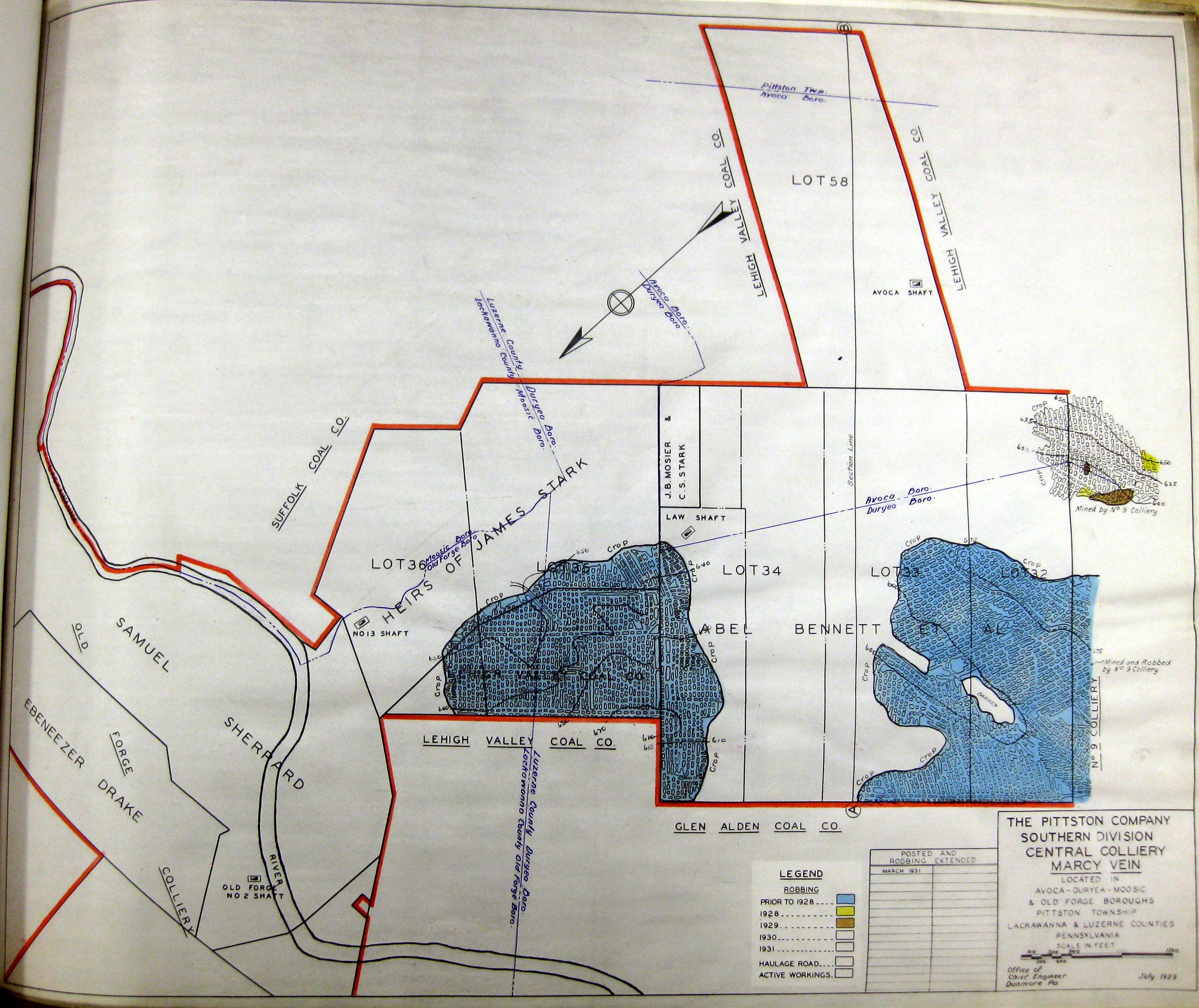
Central Colliery Marcy Vein 07-1929
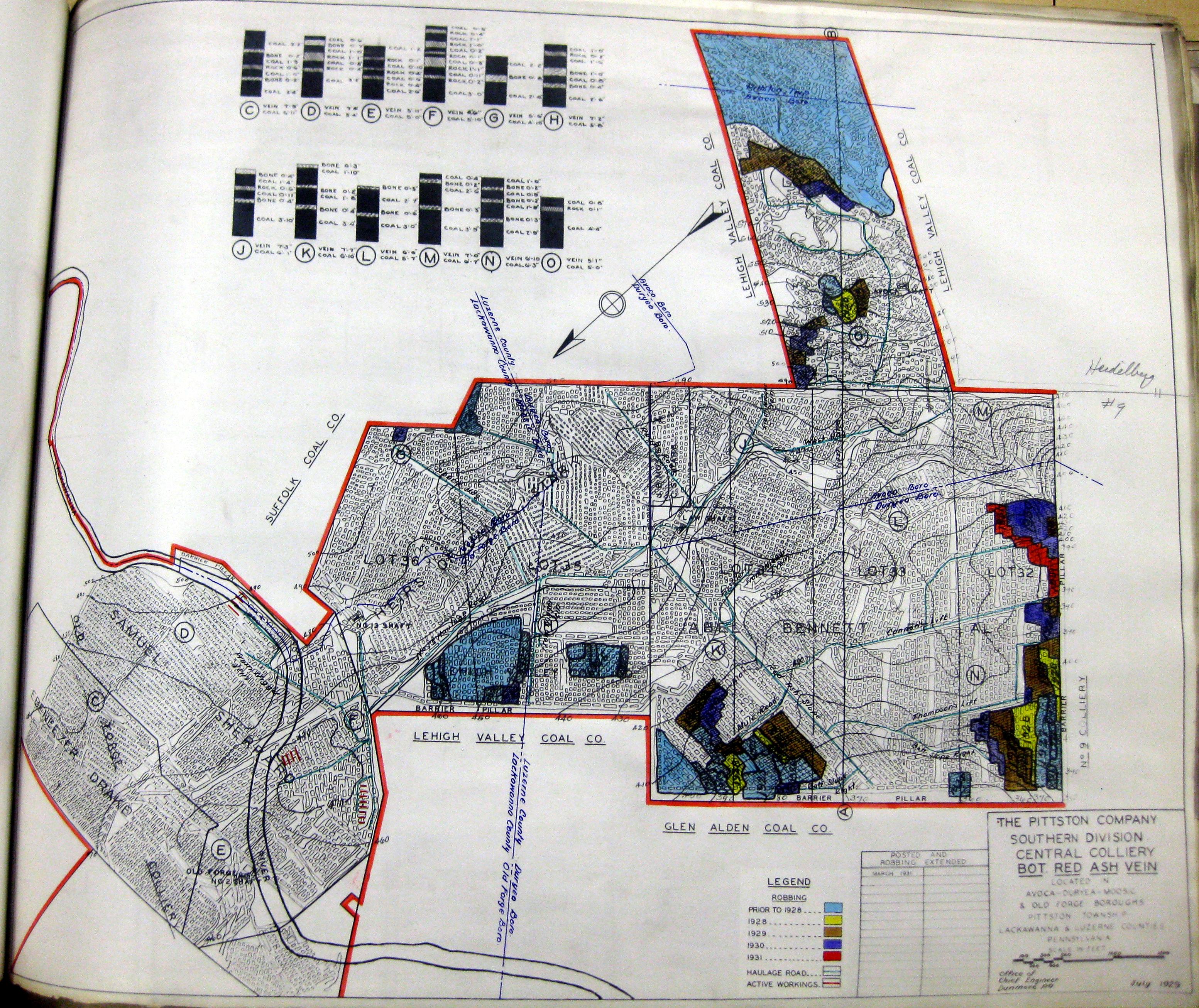
Central Colliery Red Ash Vein Bottom 07-1929
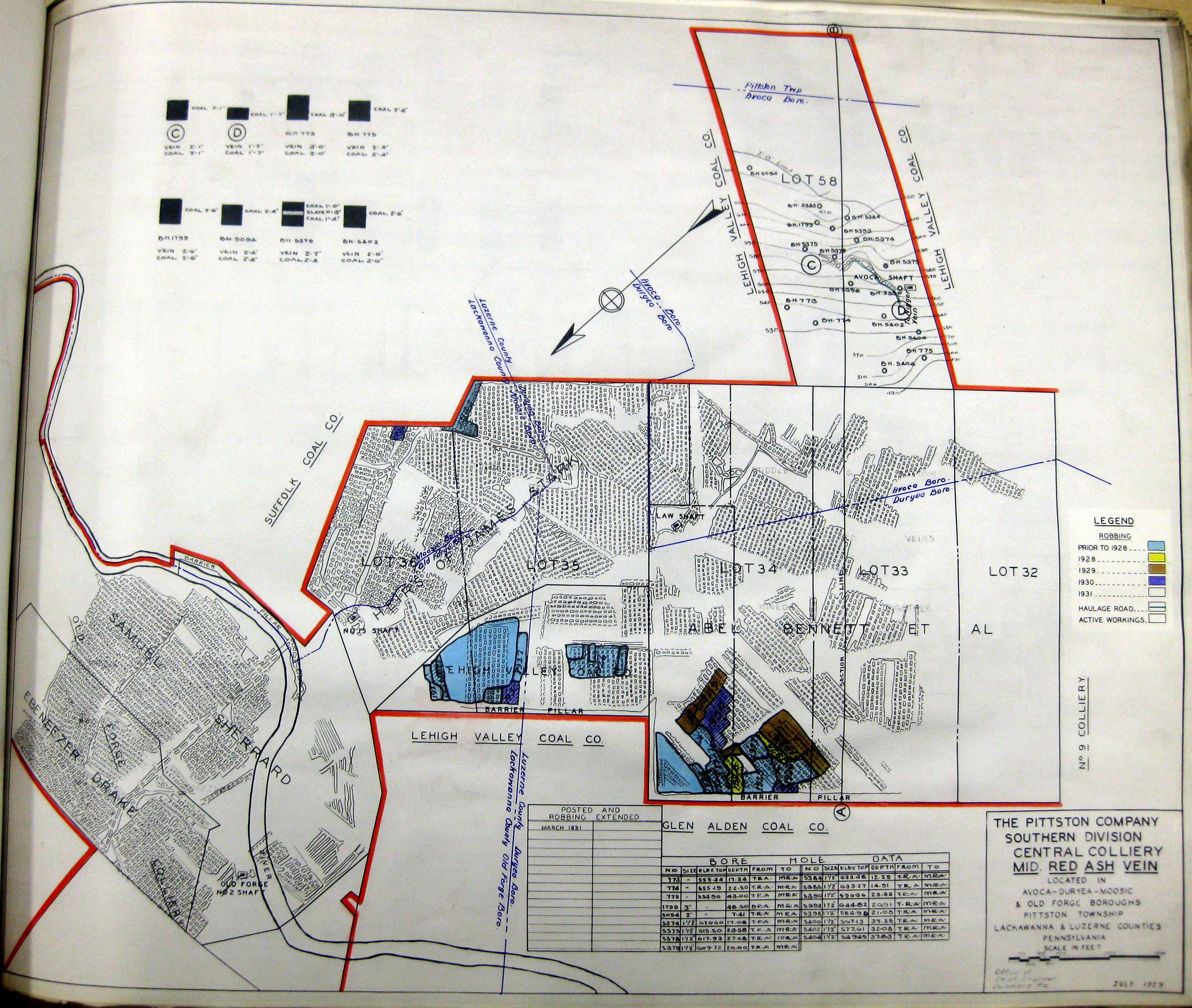
Central Colliery Red Ash Vein Middle 07-1929
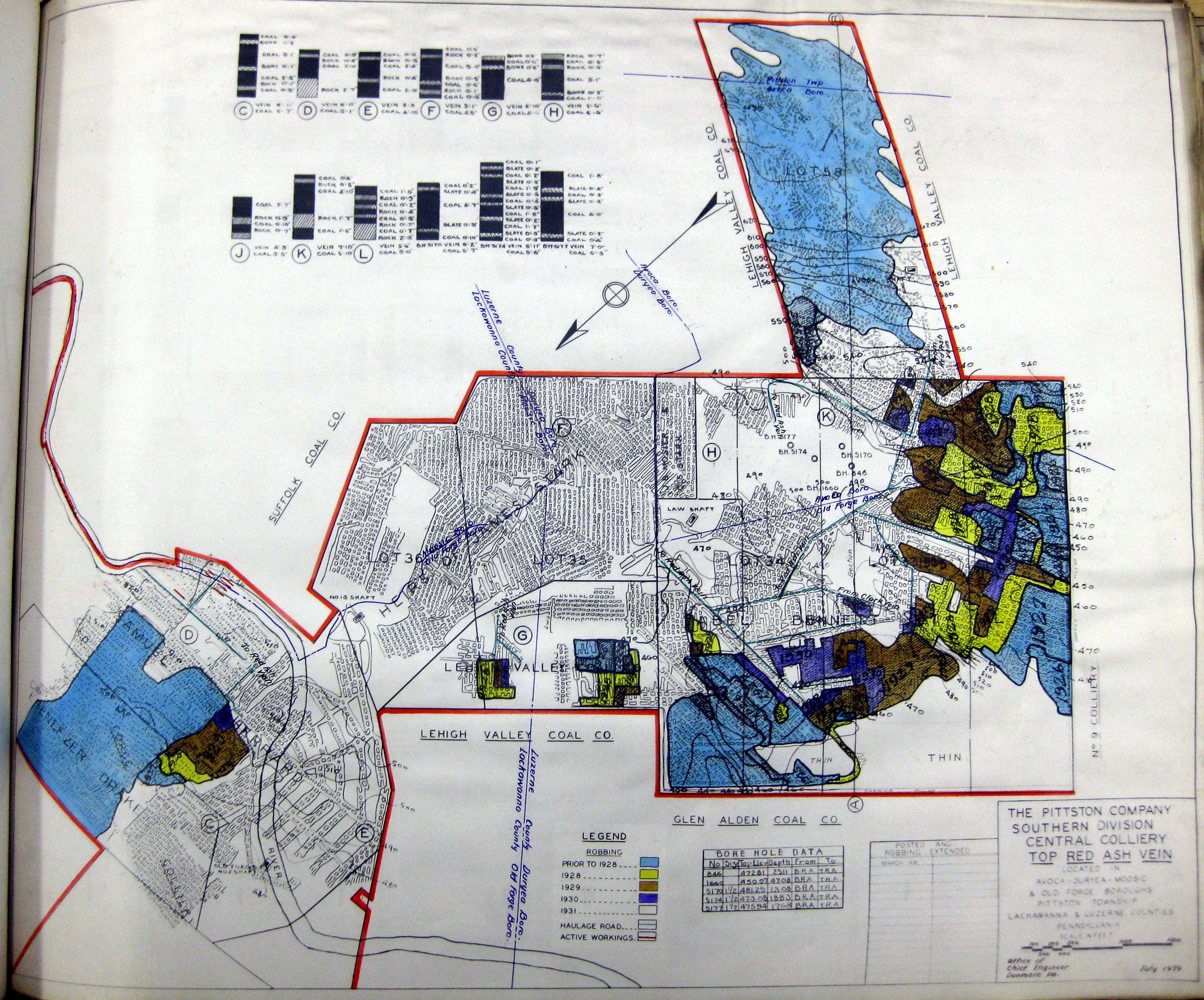
Central Colliery Red Ash Vein Top 07-1929
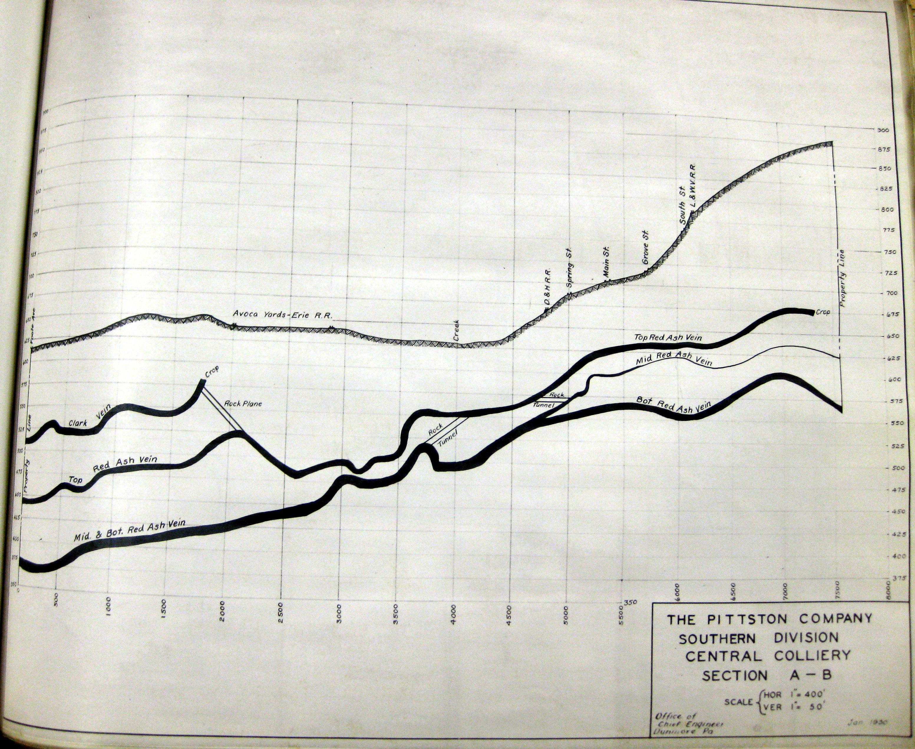
Central Colliery Section A-B 07-1929
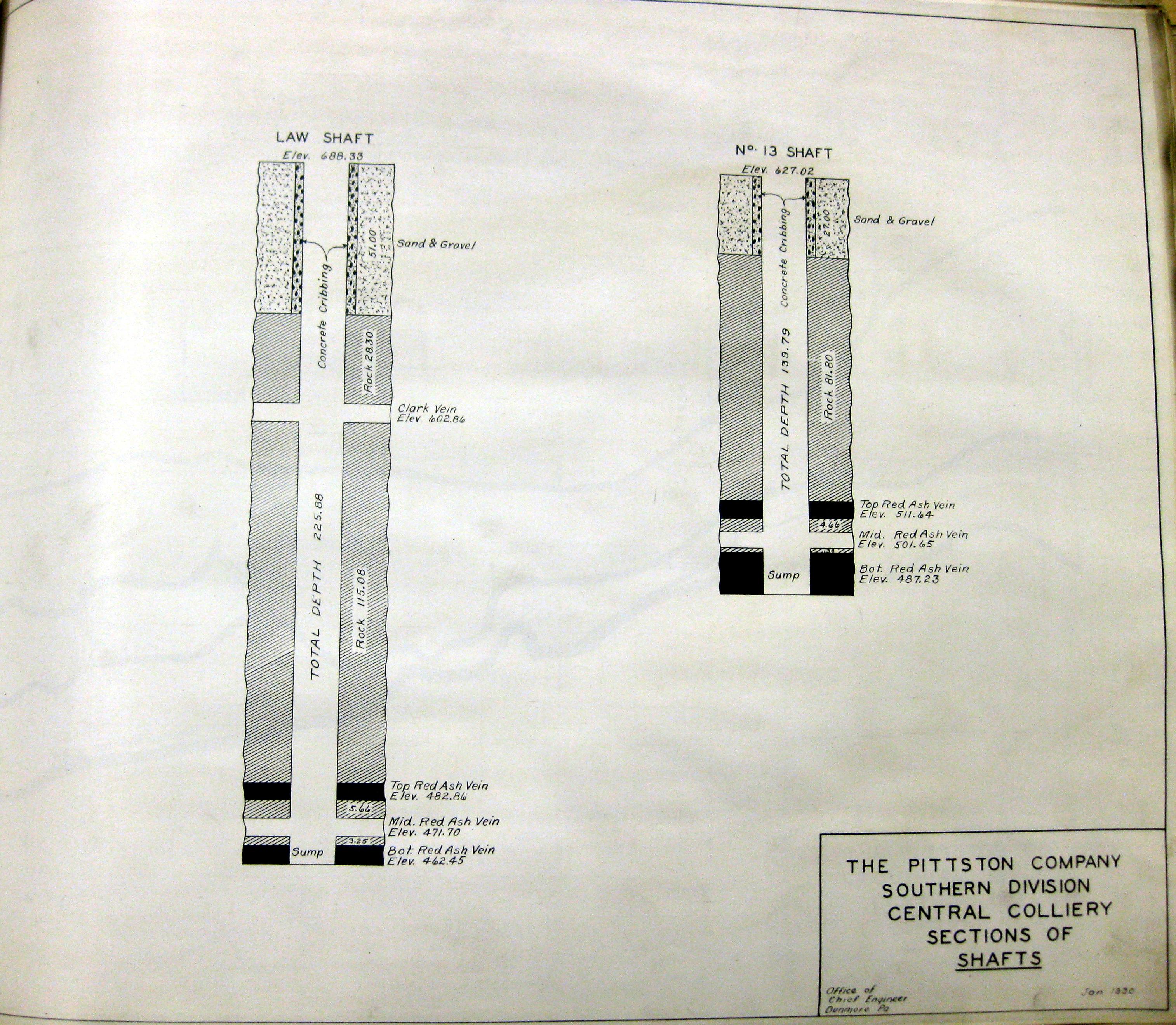
Central Colliery Sections 07-1929
Comments and Feedback